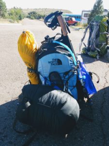
The Land of the Rising Sun from Mt. Fuji
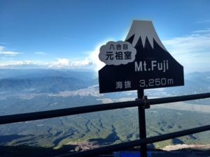
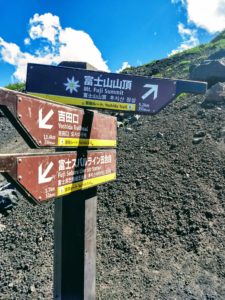
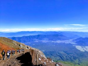
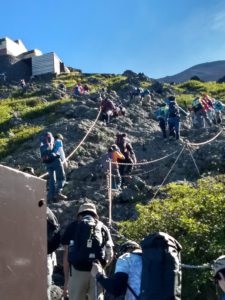 I read everything I could about Fuji but the weather was the determinant. I was staying in Tokyo for almost 3 weeks so I hoped there would be a good weather window. The weather was actually quite nice, so I planned to go on a Sunday to Monday, in hopes that there would be slightly less pilgrims than a Saturday. There were still thousands of people, but I was able to have a few moments to myself when traffic started to thin around the 7th station. Fujisan is broken into 10 stations, and most people start at the last bus stop at the 5th station.
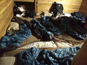
Like giant bunk beds, you had to duck as there was a layer of hikers sleeping above you. Many heads were bumped.
It only took me four hours to get to the hut via the popular Yoshida trail. I thought it would be 5-6 so I was surprised when I came up a switch back and there I was at Tomoekan, my hut at the 8th station. Since it was only 5pm I had some time to relax. I watched an amazing sunset and tried to sleep. At 10pm I still wasn’t asleep so I walked outside and watched a spectacular lightening storm in the clouds straight ahead. When I got back to Tokyo, I heard they had a wild thunderstorm. I think I finally slept a couple hours before my alarm went off at 2am. A lot of people were already geared up, but I lolly gagged because the trail sign said it was only 80 minutes to the top, and sunrise was at 5:15am.
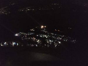
The string of lights are hikers’ headlamps.
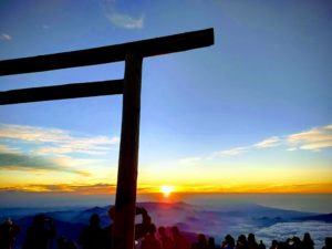
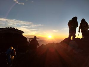
At 4:45am, I finally crossed the last torii gate that signaled the summit. That last 80 minutes actually took over two hours! The sky was just firing up and the excitement was palpable. I found a spot to sit and take pictures, and give thanks.
After a while I walked the trail along the summit which took me to the highest point on Fuji and I saw the full moon setting. It was exactly what I wanted it to be.
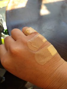
Finally close to the 6th station it started to flatten out a bit. I walked into the helmet rental hut and showed them my arm and said “Band-aid?”. They put some antiseptic on me (which is what I really wanted since I was covered in dust) and bandaged me up. I was happy again.
As I’m getting on the bus, it’s a 2.5hr trip back to Tokyo, a guy walks by wearing a Jack’s Generic shirt, a local Austin triathlon. And of course he’s from Austin but living in Tokyo now! Most of the people I’d seen in Fuji were Asians, but I wasn’t so surprised to see an Austinite, it’s a small world after all.
Tips:
- Take lots of cash for water, food snacks, postcards, and souvenirs.
- The bathrooms costs 200Y each, so bring coins as there’s no change available.
- Buy postcards and international stamps at the 5th station, and mail them at the post office at that station. You can also buy post cards at the mountain huts.
- There’s a website to help English speakers book mountain huts on the 7th station for an extra 1000Y. I missed the three day cutoff for that website, but was able to easily book myself for the 8th station and didn’t have to pay in advance.
- Take Band-Aids, or tape up your feet. They’ll take a pounding on the way down, or you may fall on jagged lava rocks.
Hike to the Top of Texas: Guadalupe Peak
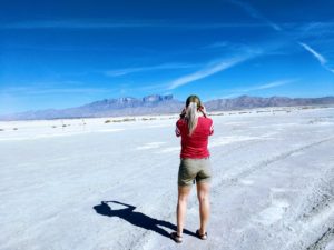
You’d have thought we were just another Thelma and Louise, without the Brad Pitt part. I woke at five a.m., eager to start our eight hour road trip to West Texas. You’ll understand if you’ve ever driven through West Texas, it’s a flat, high-speed expanse of big sky ruralness. But a perfect place to escape it all, a place to soothe your soul and an inopportune place to run out of gas. My husband might describe it differently, using more romantic and dramatic words, and perhaps that’s the point. It’s a place that will fill you up with whatever you need, that is except gasoline.
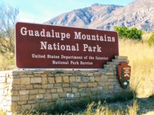
My friend, Kimberlee, and I set out to bag the summit of Guadalupe Peak, the highest natural point in Texas in the Guadalupe Mountains National Park. At an honorable 8,715 feet, it ranks 14th out of highest state points. We took Friday off of work, arriving around noon, hoping to get one of the peak’s five backpacking permits. Even though we got pulled over just outside Fort Stockton by a very kind highway patrolman, we still made great time. He reminded us to slow it down a bit and then sent us on our way. We were able to snag one of the last backpacking permits, which are free, knowing it would be a busy weekend for the Veteran’s holiday. We wanted at least four hours of daylight so we wouldn’t have to set up camp in the dark. The backpacking campground sits about a mile from the summit. We planned to be at the summit the following day in time to catch the sunrise.
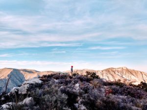
We rolled into camp in just under three hours after many stops. The weather couldn’t have been better, it was hot when we started but after rounding the bend, the trail becomes shaded and windy and a comfortable temperature. Although it was barely five p.m., Kimberlee cooked up a very tasty chicken and dumplings Mountain House dinner. By 6:30 we were snug in our Big Agnes Fly Creek tent (on clearance now at REI, plus footprint). Exhausted from the drive and hike, we fell asleep immediately but woke up often to the howling winds. My friend had recently summited, so I was well-versed in the high winds and took extra heavy duty tent stakes. But I was still nervous each time the side of the tent was mashed against my face. You could hear the wind gathering force like a giant wave, roaring up from the valley and threatening to rip the rain fly right out of the ground.
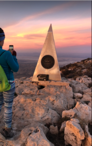
Eleven hours later, I unzipped the tent to a stunning fire banded sky – one dazzling red strip between the black. I was gobsmacked. As we headed up the summit, I kept stopping to watch the sky but had to wake myself back up and keep going. It took less than an hour, and we had enough light about halfway to turn off our headlamps. As I rounded the last corner, I saw the summit marker just above me. Victory! The wind was ruthless, but I found a small spot behind some rocks that allowed me to sit and watch the sunrise in peace. It’s a very humbling and spiritual thing to reach a summit, to see the Earth as the big beautiful thing it was intended to be, to shut out the noise and just be present.

After a short time of book signing and selfie taking, we headed back down to camp. We left our packs inside the tent to hold it down while we were gone and luckily our tent was still attached to the earth. Another backpacker said his tent had flown halfway down the hill. Our Mountain House Mac and Cheese breakfast was a fail, but nothing could break out spirits after that sunrise. We passed a lot of people on the way down hiking the peak as a day hike, but I’d highly recommend catching the sunrise or sunset at the top. It really is the best view, and you won’t have to share the moment with many others. There was only one other person for part of the time at the top with us. All in all, it took us about six and a half hours with packs.
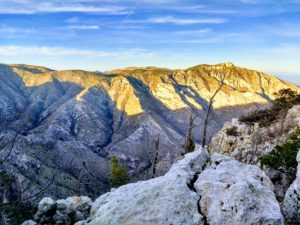
Guadalupe Mountains National Park is one of the least visited national parks, probably because of the remote location near the Texas/New Mexico border, and also because it doesn’t have many camping spots. All 20 tent spots are first-come-first-served with no reservations. When we got to the trailhead in the campgrounds about 10:30am, we were lucky to snag a campsite from someone that was just leaving. We ditched the backpacking tent, and set up a more spacious home, complete with a spot to hang my Madera Hammock.
After resting a bit, we headed over to the visitor center to check out the exhibit. It had lots of really good info on the park, and animal replicas. We also discovered that you do NOT have to be a child to become a Junior Ranger. We diligently worked on the provided workbook, and earned our first Junior Ranger badge!
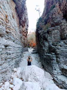
We were so excited about our new badges, we set off to hike Devil’s Hall Trail. Although, it took us less than two and a half hours, this trail did required some scrambling. It’s an easy first mile to the wash, then it’s mostly unmarked, but just keep going. If you follow the wash, you’ll eventually end up at a pretty cool site. But make sure you take a torch or keep an eye on the daylight because you are in the shaded creek bed.
Then lucky for us, there was a star viewing party that night. Two astronomers had set up their telescopes, as if the stars in that dark sky weren’t amazing enough. They pointed out some amazing sights, and we took turns on the telescopes. It was an excellent cap to the day. Some deer joined us for our Sunday morning breakfast before we packed up. Besides one roadrunner, we didn’t see much wildlife. We headed a mile up the road to the Frijole Ranch. From there, Smith Springs is about an hour easy hike that offered us some beautiful fall foliage. Not something we get a lot of in Central Texas.
We wanted to hike the McKittrick trail, which may have the best viewing for fall colors, but we were having a minor gas crisis. No matter what direction you come from, the nearest gas station may be 30 miles or more from the park. Even knowing this we failed to fill up and found ourselves driving 40 miles out of the way to Dell City. It’s a small town with two gas stations, both of which are closed on Sundays, but we asked someone on the street and they directed us to a small credit card station, so we were able to get gas before we were on fumes. It was a wonderful weekend being in nature, but I was ready for a shower. And it’d be eight short hours before I’d finally get one.
Tips:
- The Guadalupe Mountains National Park is in the Mountain Time Zone (MST), right on the border.
- Expect high winds at the top and prepare accordingly. Take extra tent stakes if you are camping, and a headband to keep your hair from whipping you in the face.
- Plan to take at least a gallon of water for Guad Peak. There is potable water near the trailheads, but not on any trails.
- The nearest gas station is at least 30 miles away from the park, plan accordingly.
- Fires are prohibited in the park, take a camp stove.
- Take trekking poles, the made a huge difference to me and I don’t usually use them.
