An Ultimate Hike in the Wonderful Woods of Arkansas
Five years ago I started coaching hikers to complete a one day charity hike with Cure Search’s Ultimate Hike, raising money for children’s cancer research. One of those years Hurricane Harvey hit, which closed down Sam Houston Forest’s Lone Star Trail and delayed our hike a couple months. This year a pandemic hit and delayed our hike, well canceled our hike really. But we decided to ride the wave this year has been and hike the Ozark Highland Trail in Arkansas, 6 months after our original planned hike. With about 6 weeks notice, we started training for the 23 miles of multiple mountain peaks. However, the Texas Hill Country doesn’t really have adequate mountains to prepare one for the trail. But we soldiered on, because at the end of the day this hike would not be about us.
After a few training hikes, the most I’d hiked was 10 miles (not recommended). I was excited for the new scenery, terrain and cool weather. About 25 hikers, coaches, and volunteers socially distance together for the weekend, temperatures were taken and high fives were discouraged. I keep coming back to hike with Cure Search because it starts to become a family when you see the same people year after year and get to meet really cool new people each hike.
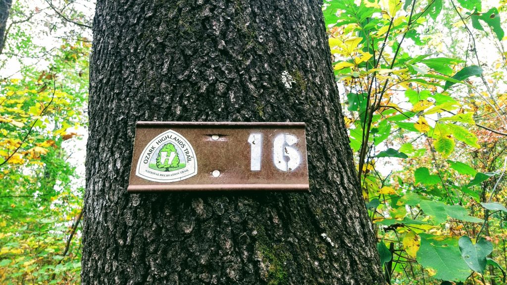
We started before dawn at 5:00 a.m. from Fane Creek concerned about our first water crossing, shortly after the trailhead. Luckily there wasn’t enough rain the day before to fill the cree. So we were able to cross without it filling our hiking boots and start our ascent.
After a couple hours, the sun started to rise, birds chirped and when the autumnal colors showed themselves we were awestruck. Coming from Texas, where it was still practically summer, I realized this is why people think October is Fall! We arrived at our first aid station about 6 miles in, 3 hours later. We stopped to refuel our water and have a snack, making sure to mask up before getting too close to any volunteers that might have to bandage our blisters.
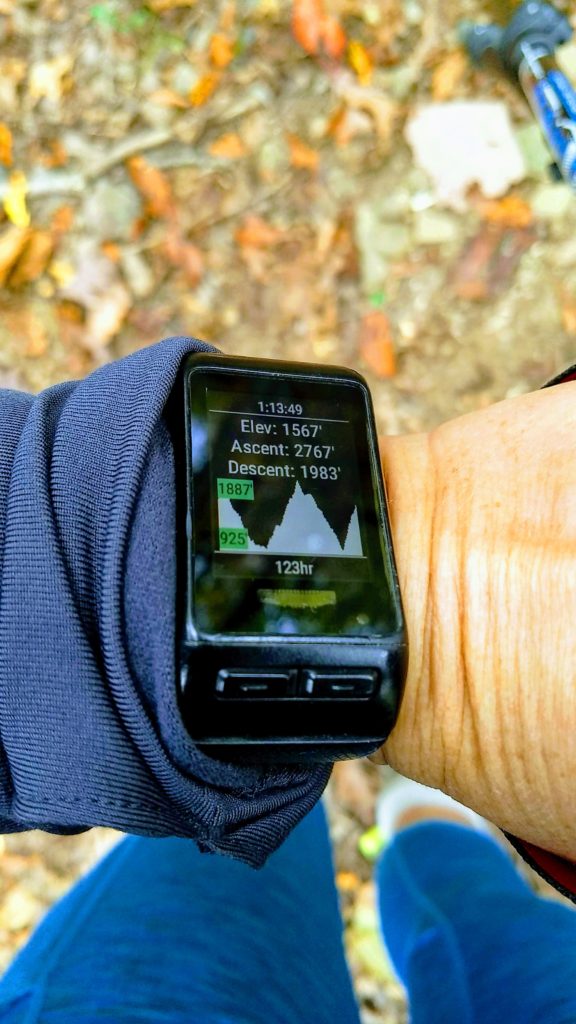
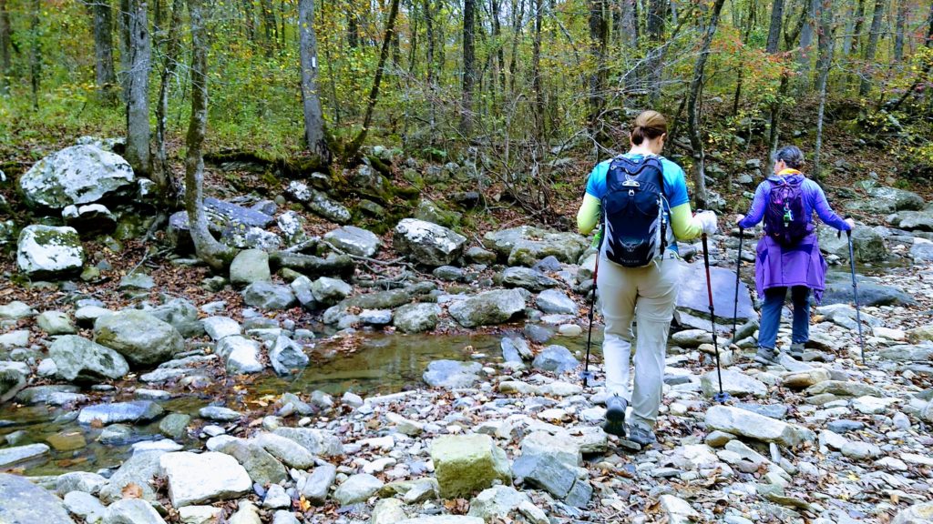
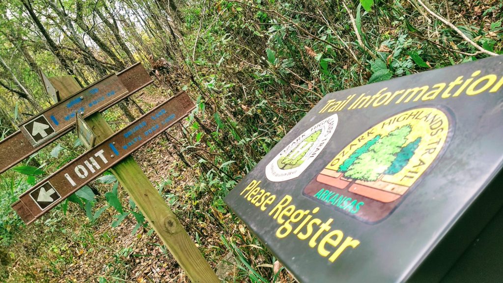
Normally, now that we had light, we’d hike faster but the next section was the hardest, at 8ish miles. That took us up and down two strong peaks, across some shallow water crossings, and by waterfalls. We even met a couple that saw a bear a couple miles ahead of us but we never encountered it ourselves. Although we’d done all right following the blazes in the dark, in the daylight the trail was well marked with mile markers also, making getting lost one less worry!
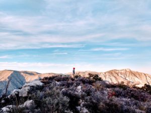
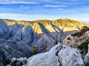
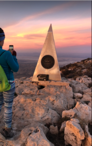
Our second aid station was at the top of White Pass Mountain, a campsite of stunning views of the forest with bright reds and oranges and greens as far as you could see. Even though we were exhausted we didn’t spend too much time resting. We still had the last 8 miles to Dockery’s Gap. Our goal was to finish by dark, plus sitting around made us cold. So after I chugged a cup of Gatorade and had my third Uncrustable for the day, we set off. At that point I was hiking with three other Texans. Even though the last section was demanding with constant climbs and significant elevation change, now every tiny hill felt significant.
The last section always seems longer, but hikers sign up for this type of event because they know they can survive it. Many hikers have survived cancer themselves or with someone they love, and pushing your body for one day is nothing compared to the grit they’ve already demonstrated. And it’s an honor for me to remind them of that. So when the sun set, we put our headlamps back on for the final push. Unfortunately this was straight up another mountain! We were greeted by the cheers of the waiting volunteers shortly after sunset, 13 and half hours after we started. We were emotionally and physically spent. And I may or may not have eaten a whole pizza before sleep overcame me.
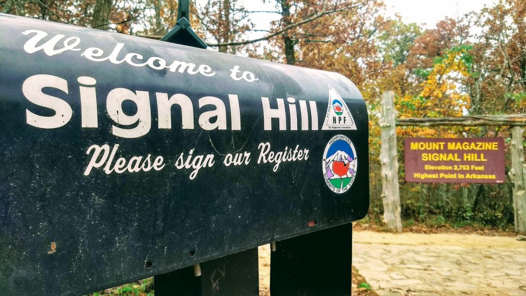
The next morning we shared battle wounds, tears and laughs before departing for the one of our many home states. But I was still on a high from the weekend. So I decided to drive to Mount Magazine and tackle the state’s highest point. Lucky for my legs, I was able to drive most of the way, and the round trip hike was only 1.5 miles! The area was gorgeous and worth the detour despite it being so foggy but I didn’t get to fully appreciate the stunning views I’d heard you get at the lodge.
During the pandemic, I’ve found myself even more thankful for parks, nature and so much outside space to explore. In that, Arkansas has a lot to offer. Driving home, I passed many signs for state parks and couldn’t resist also stopping at Devil’s Den. Also, a wonderful pit stop, if you are in the area. Trails vary in length and that take you to caves and waterfalls. All in all, Arkansas has some superb parks. I know I’ll be back to explore more on foot and bike.
Tips:
- Hiking poles are highly recommended for this trail.
- Check out one of the Ultimate Hike info sessions at REI or calls to learn about to join a hike.
- The more you hike, the more snacks you get to eat. It’s just a fact.
The Land of the Rising Sun from Mt. Fuji
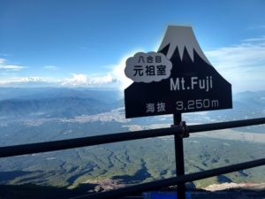
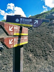
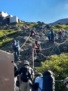 I read everything I could about Fuji but the weather was the determinant. I was staying in Tokyo for almost 3 weeks so I hoped there would be a good weather window. The weather was actually quite nice, so I planned to go on a Sunday to Monday, in hopes that there would be slightly less pilgrims than a Saturday. There were still thousands of people, but I was able to have a few moments to myself when traffic started to thin around the 7th station. Fujisan is broken into 10 stations, and most people start at the last bus stop at the 5th station.
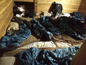
Like giant bunk beds, you had to duck as there was a layer of hikers sleeping above you. Many heads were bumped.
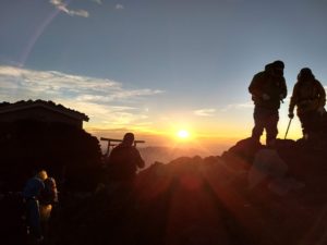
It only took me four hours to get to the hut via the popular Yoshida trail. I thought it would be 5-6 so I was surprised when I came up a switch back and there I was at Tomoekan, my hut at the 8th station. Since it was only 5pm I had some time to relax. I watched an amazing sunset and tried to sleep. At 10pm I still wasn’t asleep so I walked outside and watched a spectacular lightening storm in the clouds straight ahead. When I got back to Tokyo, I heard they had a wild thunderstorm. I think I finally slept a couple hours before my alarm went off at 2am. A lot of people were already geared up, but I lolly gagged because the trail sign said it was only 80 minutes to the top, and sunrise was at 5:15am.
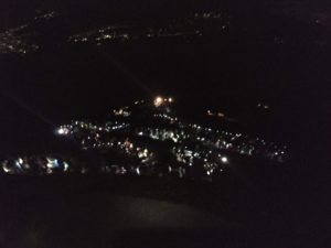
The string of lights are hikers’ headlamps.
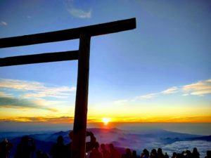
At 4:45am, I finally crossed the last torii gate that signaled the summit. That last 80 minutes actually took over two hours! The sky was just firing up and the excitement was palpable. I found a spot to sit and take pictures, and give thanks.
After a while I walked the trail along the summit which took me to the highest point on Fuji and I saw the full moon setting. It was exactly what I wanted it to be.
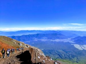
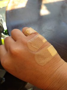
Finally close to the 6th station it started to flatten out a bit. I walked into the helmet rental hut and showed them my arm and said “Band-aid?”. They put some antiseptic on me (which is what I really wanted since I was covered in dust) and bandaged me up. I was happy again.
As I’m getting on the bus, it’s a 2.5hr trip back to Tokyo, a guy walks by wearing a Jack’s Generic shirt, a local Austin triathlon. And of course he’s from Austin but living in Tokyo now! Most of the people I’d seen in Fuji were Asians, but I wasn’t so surprised to see an Austinite, it’s a small world after all.
Tips:
- Take lots of cash for water, food snacks, postcards, and souvenirs.
- The bathrooms costs 200Y each, so bring coins as there’s no change available.
- Buy postcards and international stamps at the 5th station, and mail them at the post office at that station. You can also buy post cards at the mountain huts.
- There’s a website to help English speakers book mountain huts on the 7th station for an extra 1000Y. I missed the three day cutoff for that website, but was able to easily book myself for the 8th station and didn’t have to pay in advance.
- Take Band-Aids, or tape up your feet. They’ll take a pounding on the way down, or you may fall on jagged lava rocks.
Hiking in Argentinian Patagonia
Sometimes I worry that I’ve dreamed of a place so long, it won’t live up to my expectations. This was not the case with Patagonia. I’d wanted to go for years, and luckily this time my husband was able to travel with me. We’d spend three weeks starting in Buenos Aires, Argentina and ending in Santiago, Chile. I knew when we started this wouldn’t be nearly enough time, but nine days would at least give us a taste for all Argentina had to offer. And by taste, I mean, bring the wine and keep it coming!
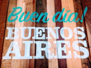
We touched down in Buenos Aires, for a short overnight before hopping another flight to El Calafate and then a bus to El Chaltén. Our trip would follow a ‘V’ pattern due to the limited flight locations in the Patagonia region. Also because I wanted to spend less time on buses and we didn’t rent a car. After nine hours flying to Buenos Aires, we dropped our bags at the hotel, got a map and went to exchange money. This was our only goal while in BA, because I’d read that changing cash in El Chaltén was hit or miss.
We spent a beautifully warm day walking around eating empanadas, but we were eager to get south. We caught our flight early the next morning out of the domestic airport. It only took 15 minutes to get from our hotel to the gate – the small airport was easy 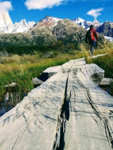
to check into, and has a cafe. Our three hour flight put us outside the town of El Calafate. We had pre-booked a shuttle to the quiet hiker’s paradise in El Chaltén. Once there, we finally checked into our hosteria where we’d stay for the next five days.
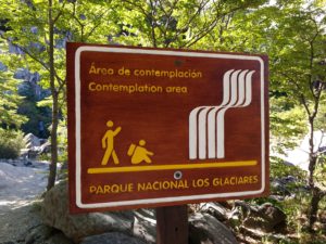
El Chaltén, Argentina’s trekking capital, can be walked end to end in 15 minutes. We heard many accents and languages, even a hiker couple fighting in English which was neither of their first language. There are restaurants, bars, a couple grocery stores, laundry facilities, a bus stop and not much else. The ranger station provides free trail maps of Los Glacieres National Park, which makes up a portion of Patagonia, and we planned to do day hikes each day. The routes lasted anywhere from one hour to five days and all the trails can be accessed directly from town.
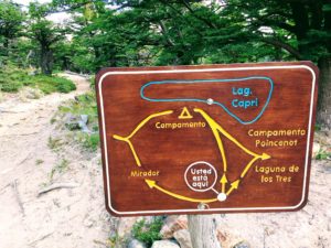
The trails are easily marked and well established, we never worried about getting lost. There are also large maps at the main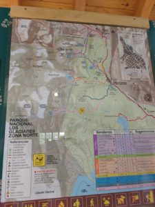
trailheads, and even rangers there answering questions and reminding hikers of trail etiquette and keeping the park clean. A few primitive bathrooms were also available. I was very impressed with not only the trails but the views – WOW! The views of the Fitz Roy mountain and surrounding peaks and green lagunas were worth the hikes. The week offered mostly clear, sunny skies but a lot of wind, for that area mother nature was at her tip top best. Although we went in high season, we never felt like the trails were crowded. We’d see lots of people at the major viewpoints, but often we’d be walking alone, which was perfect. A few days in we decided to go for a sunrise hike near town. I heard you could see the sun hit the mountains spectacularly, and it was just that. It was a short, very quiet 45 minute hike to Los Condores, and we weren’t even the first ones. A handful of other tourists had arrived before us.
Hiking in the Patagonia region reminded me of what I enjoy about hiking – the scenery, the challenge, but mostly the peacefulness. Each evening after hiking, we’d have a big dinner and a bottle of wine, and it was very rejuvenating. It was also really hard to leave. I’d felt like I spent so much time researching this trip, but being there it was really quite easy. Even if I was a solo female hiker, I would have felt very safe. But we were really excited to get back to El Calafate.
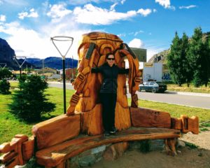
You know you are in a backpacker’s paradise when the city park bench looks like a giant pack.
We took a bus back to El Calafate and we had the afternoon to explore, and while it was defiantly livelier than El Chaltén, we were still able to walk almost everywhere. Almost everywhere – we heard about a Glacier Museum with an ice bar that sounded fun. So, we found their free shuttle bus that took us the three miles to the museum. I can’t say how the museum is, but the Glacio Bar was a blast! The museum itself is in a beautiful building, and the bar is in the basement. We paid the $10USD per person, and got a 25 minute all you can drink, “this is what it must feel like inside a freezer” experience. After donning the provided capes and kitchen mittens, our group entered the tiny room. The few tables, chairs, bar and glasses were all made of ice, and the club lights and Justin Bieber music had me drinking and dancing just to stay warm! It took about five minutes before I was cold (I’m from Texas after all), but my husband said that’s what the straight vodka was for! It was hilarious, and absolutely worth it to take the unexpected detour – as it usually is.
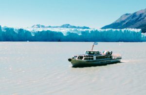
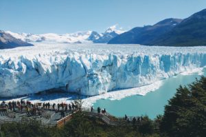
The next day we visited the Perito Moreno Glacier to do ice trekking with Heilo y Aventura. They are the only company that offer glacier trekking, and it was definitely a highlight. It’s much cheaper to take the local bus, but we really wanted to wear crampons and hike on a glacier. If you can spend the money, I’d highly recommend this excursion. The tour includes a boat ride across the lake, where you get your first glimpse of the glacier’s magnitude. The most interesting thing about it is that it’s advancing and not receding like most glaciers. We got a trekking tour on the glacier, had lunch and took the boat back across the lake. Once across that lake, we took the bus to the main park where the viewing boardwalks are packed with spectators waiting for the ice to calve. And when it did, it was an amazing site! But after trying to get a good view around so many people, we were even happier we took the tour because it felt more private.
We were headed to Chile early the next day, so we had one last dinner of lamb and wine. It wasn’t hard to travel around by buses and that’s how most people got around. But we were limited to the days the buses crossed the border. I had only really planned one thing for this trip and that was a day in Antarctica, so no matter what else we did I had to be in Chile on a specific day. Unfortunately, that was a day there was not a bus from Argentina to Chile.
After some searching, I emailed a couple different companies to see if they had private shuttles that would leave early enough to get us across the border to Puerto Natales. Once there we’d catch another bus to Punta Arenas, Chile. Emails were sent, and payments were made via PayPal, so I wasn’t super confident this was legit. But after the whole trip, all the pre-booked transportation I made was on time and exactly as described. So, a large charter bus showed up at our hotel bright and early with many other travelers in the same situation. The border crossing was quick and easy to get our passports stamped leaving Argentina. We stopped again five minutes later at the Chile border. It was also easy but remember to not take any fruit or nuts with you! They made me throw away a banana and an apple, even after I asked if I could just eat it right then – that was my breakfast after all.
There are many parks that make up Patagonia, and after being there I’m eager to explore more of them. All in all Argentina had been everything I hoped, but now on to Chile!
Tips:
- Change dollars to Argentinian Pesos in a big city before traveling south to Patagonia. There’s only one ATM in El Chalten,
 which apparently runs out of cash, plus many places don’t take credit cards.
 - The WIFI is slow, and I didn’t see one TV in town, including in our hotel (just in case you were hoping to watch the Olympics).
- The daylight hours are long in summer.
- Many hotels have lunchbox (“viandas”) options, that are prepared and ready for you the morning of your hike, costing about $10-15USD.
- If you cross the border, check for items not allowed to avoid throwing away food. Food is not cheap there.
Hike to the Top of Texas: Guadalupe Peak
You’d have thought we were just another Thelma and Louise, without the Brad Pitt part. I woke at five a.m., eager to start our eight hour road trip to West Texas. You’ll understand if you’ve ever driven through West Texas, it’s a flat, high-speed expanse of big sky ruralness. But a perfect place to escape it all, a place to soothe your soul and an inopportune place to run out of gas. My husband might describe it differently, using more romantic and dramatic words, and perhaps that’s the point. It’s a place that will fill you up with whatever you need, that is except gasoline.
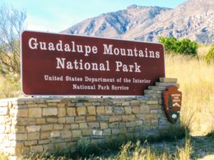
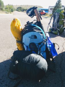
My friend, Kimberlee, and I set out to bag the summit of Guadalupe Peak, the highest natural point in Texas in the Guadalupe Mountains National Park. At an honorable 8,715 feet, it ranks 14th out of highest state points. We took Friday off of work, arriving around noon, hoping to get one of the peak’s five backpacking permits. Even though we got pulled over just outside Fort Stockton by a very kind highway patrolman, we still made great time. He reminded us to slow it down a bit and then sent us on our way. We were able to snag one of the last backpacking permits, which are free, knowing it would be a busy weekend for the Veteran’s holiday. We wanted at least four hours of daylight so we wouldn’t have to set up camp in the dark. The backpacking campground sits about a mile from the summit. We planned to be at the summit the following day in time to catch the sunrise.
We rolled into camp in just under three hours after many stops. The weather couldn’t have been better, it was hot when we started but after rounding the bend, the trail becomes shaded and windy and a comfortable temperature. Although it was barely five p.m., Kimberlee cooked up a very tasty chicken and dumplings Mountain House dinner. By 6:30 we were snug in our Big Agnes Fly Creek tent (on clearance now at REI, plus footprint). Exhausted from the drive and hike, we fell asleep immediately but woke up often to the howling winds. My friend had recently summited, so I was well-versed in the high winds and took extra heavy duty tent stakes. But I was still nervous each time the side of the tent was mashed against my face. You could hear the wind gathering force like a giant wave, roaring up from the valley and threatening to rip the rain fly right out of the ground.
Eleven hours later, I unzipped the tent to a stunning fire banded sky – one dazzling red strip between the black. I was gobsmacked. As we headed up the summit, I kept stopping to watch the sky but had to wake myself back up and keep going. It took less than an hour, and we had enough light about halfway to turn off our headlamps. As I rounded the last corner, I saw the summit marker just above me. Victory! The wind was ruthless, but I found a small spot behind some rocks that allowed me to sit and watch the sunrise in peace. It’s a very humbling and spiritual thing to reach a summit, to see the Earth as the big beautiful thing it was intended to be, to shut out the noise and just be present.
After a short time of book signing and selfie taking, we headed back down to camp. We left our packs inside the tent to hold it down while we were gone and luckily our tent was still attached to the earth. Another backpacker said his tent had flown halfway down the hill. Our Mountain House Mac and Cheese breakfast was a fail, but nothing could break out spirits after that sunrise. We passed a lot of people on the way down hiking the peak as a day hike, but I’d highly recommend catching the sunrise or sunset at the top. It really is the best view, and you won’t have to share the moment with many others. There was only one other person for part of the time at the top with us. All in all, it took us about six and a half hours with packs.
Guadalupe Mountains National Park is one of the least visited national parks, probably because of the remote location near the Texas/New Mexico border, and also because it doesn’t have many camping spots. All 20 tent spots are first-come-first-served with no reservations. When we got to the trailhead in the campgrounds about 10:30am, we were lucky to snag a campsite from someone that was just leaving. We ditched the backpacking tent, and set up a more spacious home, complete with a spot to hang my Madera Hammock.
After resting a bit, we headed over to the visitor center to check out the exhibit. It had lots of really good info on the park, and animal replicas. We also discovered that you do NOT have to be a child to become a Junior Ranger. We diligently worked on the provided workbook, and earned our first Junior Ranger badge!
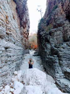
We were so excited about our new badges, we set off to hike Devil’s Hall Trail. Although, it took us less than two and a half hours, this trail did required some scrambling. It’s an easy first mile to the wash, then it’s mostly unmarked, but just keep going. If you follow the wash, you’ll eventually end up at a pretty cool site. But make sure you take a torch or keep an eye on the daylight because you are in the shaded creek bed.
Then lucky for us, there was a star viewing party that night. Two astronomers had set up their telescopes, as if the stars in that dark sky weren’t amazing enough. They pointed out some amazing sights, and we took turns on the telescopes. It was an excellent cap to the day. Some deer joined us for our Sunday morning breakfast before we packed up. Besides one roadrunner, we didn’t see much wildlife. We headed a mile up the road to the Frijole Ranch. From there, Smith Springs is about an hour easy hike that offered us some beautiful fall foliage. Not something we get a lot of in Central Texas.
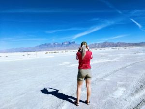
We wanted to hike the McKittrick trail, which may have the best viewing for fall colors, but we were having a minor gas crisis. No matter what direction you come from, the nearest gas station may be 30 miles or more from the park. Even knowing this we failed to fill up and found ourselves driving 40 miles out of the way to Dell City. It’s a small town with two gas stations, both of which are closed on Sundays, but we asked someone on the street and they directed us to a small credit card station, so we were able to get gas before we were on fumes. It was a wonderful weekend being in nature, but I was ready for a shower. And it’d be eight short hours before I’d finally get one.
Tips:
- The Guadalupe Mountains National Park is in the Mountain Time Zone (MST), right on the border.
- Expect high winds at the top and prepare accordingly. Take extra tent stakes if you are camping, and a headband to keep your hair from whipping you in the face.
- Plan to take at least a gallon of water for Guad Peak. There is potable water near the trailheads, but not on any trails.
- The nearest gas station is at least 30 miles away from the park, plan accordingly.
- Fires are prohibited in the park, take a camp stove.
- Take trekking poles, the made a huge difference to me and I don’t usually use them.
The Sun Never Sets in Wyoming
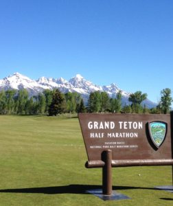
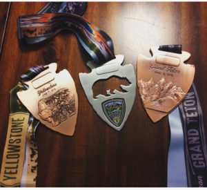
Ok, it does but not until after 9pm in June, and it’s up again at 5am. The days are long, but oh were they fun-filled. I’d always wanted to go to the Grand Tetons and Yellowstone National Parks and after hearing about a friend’s trip. I knew I had to go, it just took a few years getting there. When I heard about Vacation Races half marathons by both parks, I immediately signed up. No big deal running two half marathons a week apart, especially if it got me out to the wild west, right? Not to mention this is the centennial year of the national park service – I was being called.
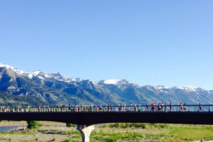
Runners on the race route.
Well, 12 hours after landing in Jackson, WY, I ran my fourth half marathon on the most beautiful race course ever. With the Tetons in view, and a friend at my side I was praising God for his creation! And the week kept getting better. The next day, my motorcycle-riding husband took me on my longest motorcycle ride ever. Previously I’d ridden maybe five miles in the neighborhood, so he was pretty proud of me at mile 175. We rented a sport touring BMW to drive by the Targhee National Forest in Idaho and back through the Teton pass. As we arrived back into GTNP we even spotted a black bear near a stream!
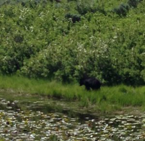
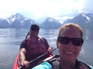
We spent our days, hiking to geysers and waterfalls, kayaking on Colter Bay and mountain biking in Montana. We met a few people around Jackson that may have been tired of tourists, but everyone we encountered after leaving Jackson was wonderful. And I have a new appreciation for the National Park Rangers because the second time we saw a bear, it was a Grizzly! And the second time, like the first, there was a ranger there making sure everyone stayed a safe distance, while reprimanding three people who decided to tromp through the woods to get a better view. I couldn’t believe the stupidity, but shouldn’t be so surprised after the article a few weeks ago about the guy who put a bison calf in his car because he thought it was cold! My husband and I could hike for hours without ever saying a word – which is the worst thing to do in bear country – so I was always looking over my shoulder.
The guy who invented bear spray was a genius, I must say! That stuff sells for $50 a pop, and probably 99% of the tourists who buy it never use it – but I get it, its like insurance.
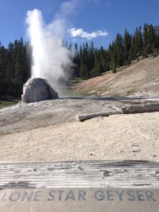
The National Parks are built around accessibility. They even have a program called Every Kid in a Park which allows all 4th graders and their families free entry. However, it took very little effort – just stepping off the main trail to find lovely solitude. Old Faithful hosts thousands of visitors for its 90 second display. Being from Texas, we walked a flat five mile round trip to the Lone Star Geyer and watched its splendor for 20 minutes with only a dozen other people.
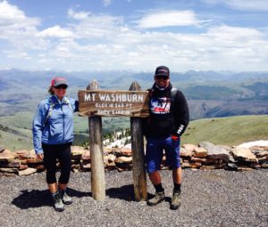
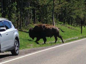
I’d be remiss if I didn’t mention the bison. They cross the roads at their leisure, causing traffic jams on the one lane park roads. The parks are teeming with wildlife. Big horn sheep live at the top of the still snowy and incredibly windy Mt. Washburn, the big antlered moose – that is plural and not to be confused with meese, which is not a thing – and the elk, including the one that ran in front of us while we were on the motorcycle. We also saw lot of chipmunks, marmots, geese, and a mouse that ran across the floor of our cabin.
Be prepared to spend lots of money. Ok, hiking is free and camping is cheaper than cabins and motels. But I camped when I ran the Yosemite half marathon and knew I needed a real bed this time. We also decided to try all the local beers along the way, and didn’t find any happy hours!
We spent the last day in Montana. I completed the Yellowstone half marathon (while we probably walked that every day) and we wrapped it up with a five mile hike to Storm Castle. I called it quits after that, so we headed to Bozeman for our last night. They say you only regret the things you didn’t do – we will have no such regrets. After 3 states, 2 half marathons, 2 bears, many mountains, and 1 motorcycle ride it was time to head home.
Tips:
- Take t
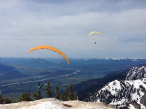 he Aerial Tram in Teton village or hike to the top of Rendezvous Mt. There was still snow, and it’s windy (like Mt. Washburn) but we watched about ten paragliders take off from the top in spectacular form.
 - Step off the very well beaten sidewalk path if you are physically able – it’s worth it.
- Breath. The air and smell of pine is lovely.
- Get on the water. The area has many lakes. You can take a scenic cruise, kayak, canoe or fishing trip to get a new perspective.
- Eat bison burgers!
- Visit the Grand Prismatic Spring – pictures don’t do it justice.
- See the stars – no, seriously. Someone please do it and report back, I was always too tired!