Exploring the variety of Texas State Parks
I already spend a lot of time outdoors, but like many people during the pandemic, I was looking to spend more time in the state parks. Texas has 51 state parks, compared to its 2 National Parks. So, this was a good year to invest in a Texas State Park Pass and state exploring. Here’s a few of the stops I made.
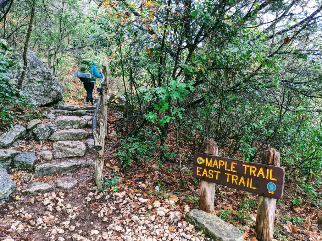
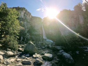
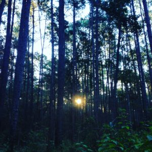
Bastrop State Park – This is a small park super close to Austin, and the proximity makes for an easy camping weekend or day hike and keep this park quite busy. Many will remember it was ravaged by wildfires 10 years ago, and the burnt trees still standing are an important reminder. There are few miles of easy hiking trails and good paved trails for biking, or hook up with the neighboring Buescher Park for some hilly road cycling.
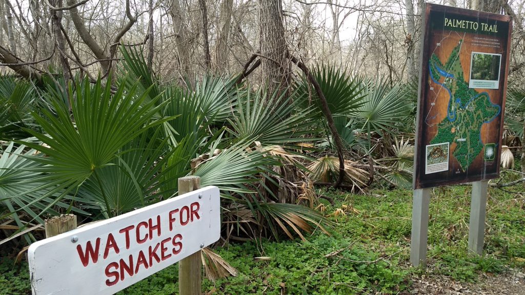
Palmetto State Park – This little park was a great day trip but camping is also available. You can SUP, they even have rentals, or enjoy hiking some easy flat trails through the Palmettos.
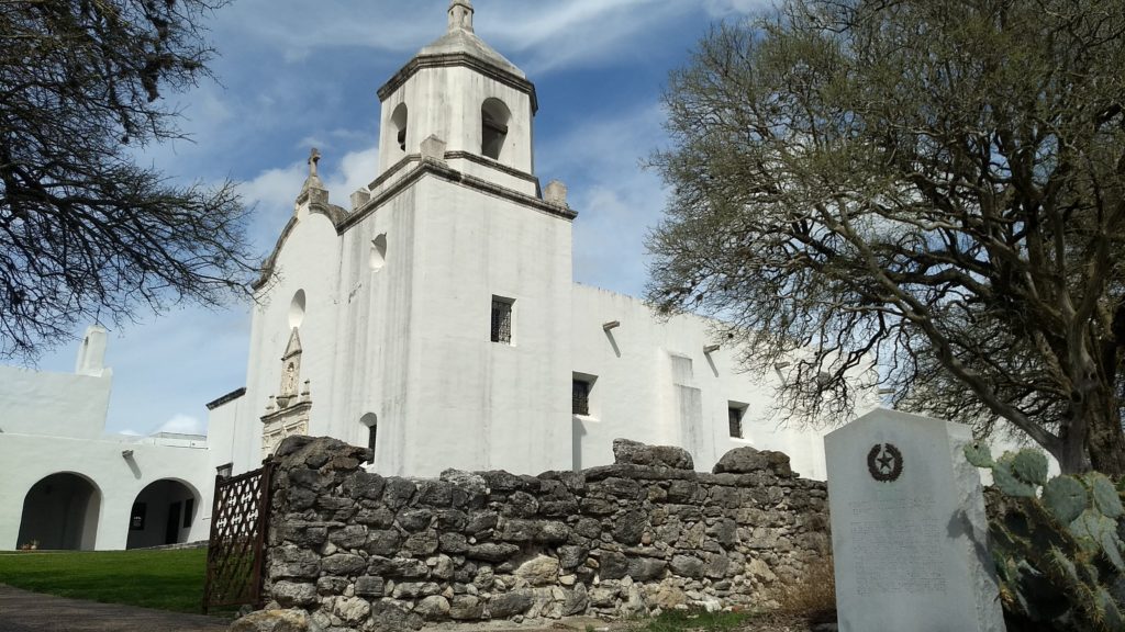
Goliad State Park – This historical park has short trails but is right on the San Antonio river, where you can camp, paddle and learn more about Cinco de Mayo. Spend time exploring the mission and the museum down the street. Even if you don’t hike or camp, it’s worth a stop for the beautiful mission.
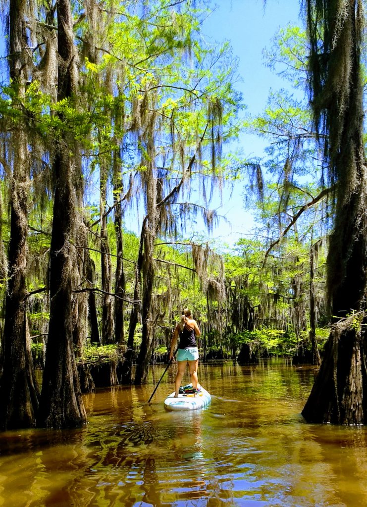
Caddo Lake State Park – Close to the Louisiana border, this park was definitely worth the drive. We booked a shelter only because it was the last camp stop available, which was lucky when a thunderstorm rolled in the first night. I couldn’t believe it didn’t flood and wasn’t very muddy, and the shelter was just enough to keep up dry. And the bathrooms were clean. Make sure to SUP or paddle, weaving in and out of the spooky baldy cypress trees takes you to the river. There’s only about 2.2 miles of trails, but we spent most of the day on the water. For the scenery and water fun, this was an excellent road trip.
Inks Lake State Park – Another very popular park in the Texas hill country. On a calm day you can SUP, but it’s very hard on a windy day! Lots of people enjoy hiking and boating here, and there lots of shaded picnic tables for day or overnight use.
Palo Pinto Mountains State Park – I signed up for the Ultra Expeditions Hidden Hills Race specifically to check out this new state park that’s not yet open to the public. The race gave us a small glimpse of the park with fields of wildflowers galore and also a lot of mosquitos. The hills weren’t too bad, and there were good stretches of the 10k that were relatively flat. I can’t wait for the park to be open, but that will probably be a few years out.
Mustang Island State Park – The Padre Island National Seashore protects 70 miles of beach, in addition to that there are other protected areas. Indoor and outdoor showers, and covered picnic structures make beach days even better.
Aransas National Wildlife Refuge – We went for the whooping cranes, but got to see so much more wildlife than I expected. Deer, alligators, and a variety of birds like spoonbills can be seen from the trails or view points. Bonus – this park is near the oldest tree in Texas.

Lost Maples State Natural Area – I’d been wanting to go here for years, and even though I thought the timing was right the maples weren’t showing off just yet. This park is very popular for day or overnight camping. The primitive camp sites are an easy mile+, but some of the hikes that offer amazing views are very steep. I’m glad I finally went, but it wasn’t more amazing than many of the other parks.
Hill Country State Natural Area – I was here for a trail race and what most struck me was the trails I explored were all exposed. Which is something to consider in the summer, although my primitive campsite was shaded. Well marked trails and nice vistas, and close proximity to Bandera, but otherwise not a park I’d go out of my way to visit.
Guadalupe River State Park – An easy two hour drive from Austin, but definitely in a flight path, as we heard many planes passing overhead. Even though Guadalupe River State park is close, it was my first visit and definitely worth it. I’m sure with the easy river access, it’s a popular park in the summer. We rented a teardrop camper for the two night trip, and it was a lovely sunny couple of days. 70 degree high in February is perfect camping weather. Our camper had a bed and kitchen, so the clean and brand new bathrooms with private showers were very ideal. It was an easy 6 mile afternoon hike, although there were more miles of trails on the other side of the river you can drive to. The wildlife was pretty good – 3 does, more armadillos than I could count, one possum and lots of birds – although it wasn’t golden cheek warbler season yet.
What’s your favorite Texas State Park and why? The vastness of the state lends itself to a variety of parks, so get out there and enjoy!
Tips:
- Make reservations well in advance.
- Make it a day trip, if you aren’t into camping. Take a picnic and enjoy the great outdoors.
An Ultimate Hike in the Wonderful Woods of Arkansas
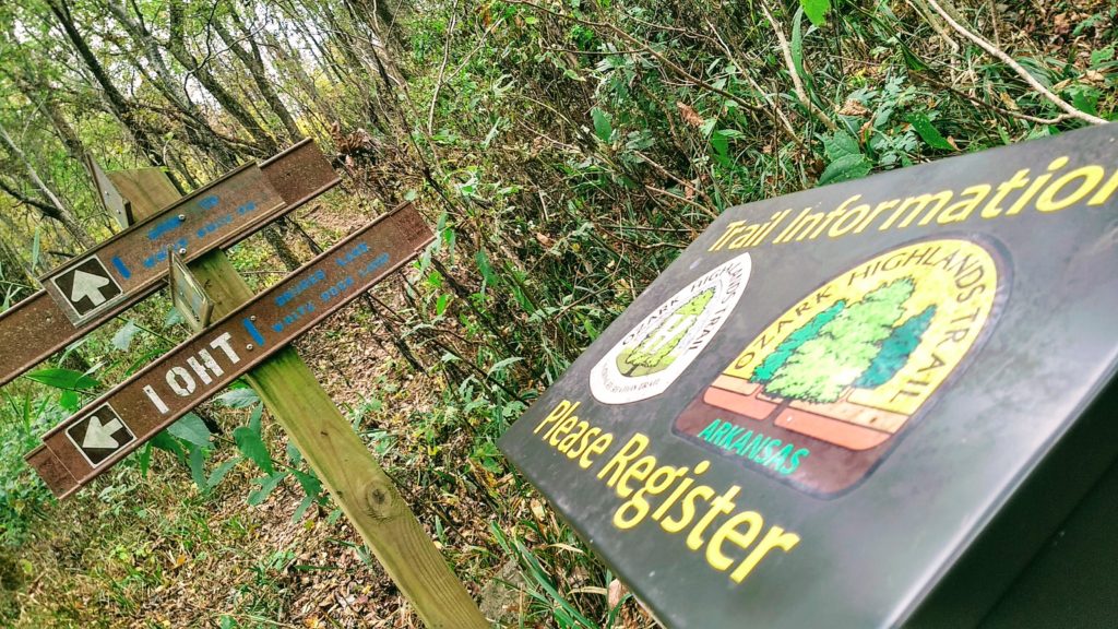
Five years ago I started coaching hikers to complete a one day charity hike with Cure Search’s Ultimate Hike, raising money for children’s cancer research. One of those years Hurricane Harvey hit, which closed down Sam Houston Forest’s Lone Star Trail and delayed our hike a couple months. This year a pandemic hit and delayed our hike, well canceled our hike really. But we decided to ride the wave this year has been and hike the Ozark Highland Trail in Arkansas, 6 months after our original planned hike. With about 6 weeks notice, we started training for the 23 miles of multiple mountain peaks. However, the Texas Hill Country doesn’t really have adequate mountains to prepare one for the trail. But we soldiered on, because at the end of the day this hike would not be about us.
After a few training hikes, the most I’d hiked was 10 miles (not recommended). I was excited for the new scenery, terrain and cool weather. About 25 hikers, coaches, and volunteers socially distance together for the weekend, temperatures were taken and high fives were discouraged. I keep coming back to hike with Cure Search because it starts to become a family when you see the same people year after year and get to meet really cool new people each hike.
We started before dawn at 5:00 a.m. from Fane Creek concerned about our first water crossing, shortly after the trailhead. Luckily there wasn’t enough rain the day before to fill the cree. So we were able to cross without it filling our hiking boots and start our ascent.
After a couple hours, the sun started to rise, birds chirped and when the autumnal colors showed themselves we were awestruck. Coming from Texas, where it was still practically summer, I realized this is why people think October is Fall! We arrived at our first aid station about 6 miles in, 3 hours later. We stopped to refuel our water and have a snack, making sure to mask up before getting too close to any volunteers that might have to bandage our blisters.
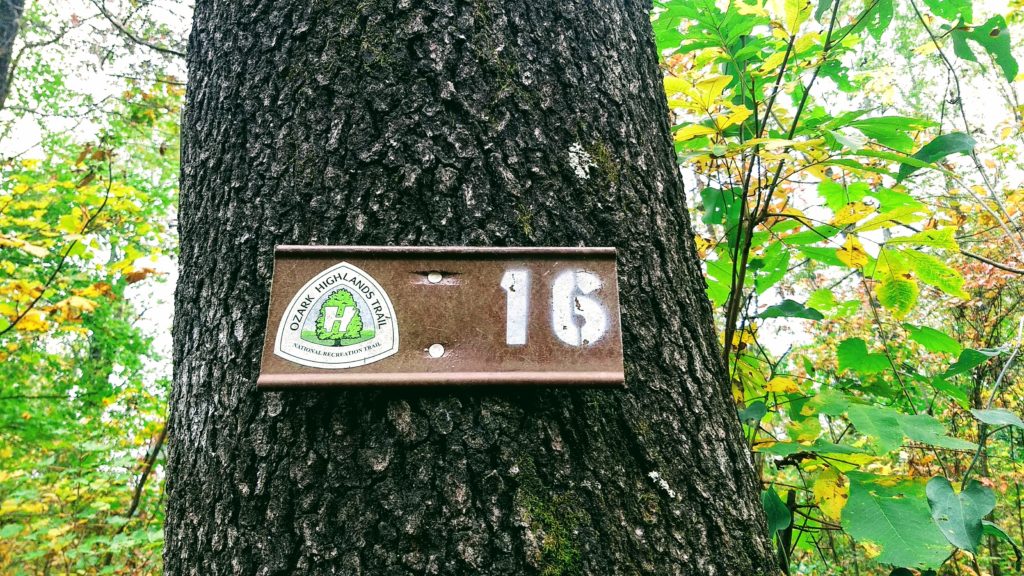
Normally, now that we had light, we’d hike faster but the next section was the hardest, at 8ish miles. That took us up and down two strong peaks, across some shallow water crossings, and by waterfalls. We even met a couple that saw a bear a couple miles ahead of us but we never encountered it ourselves. Although we’d done all right following the blazes in the dark, in the daylight the trail was well marked with mile markers also, making getting lost one less worry!
Our second aid station was at the top of White Pass Mountain, a campsite of stunning views of the forest with bright reds and oranges and greens as far as you could see. Even though we were exhausted we didn’t spend too much time resting. We still had the last 8 miles to Dockery’s Gap. Our goal was to finish by dark, plus sitting around made us cold. So after I chugged a cup of Gatorade and had my third Uncrustable for the day, we set off. At that point I was hiking with three other Texans. Even though the last section was demanding with constant climbs and significant elevation change, now every tiny hill felt significant.
The last section always seems longer, but hikers sign up for this type of event because they know they can survive it. Many hikers have survived cancer themselves or with someone they love, and pushing your body for one day is nothing compared to the grit they’ve already demonstrated. And it’s an honor for me to remind them of that. So when the sun set, we put our headlamps back on for the final push. Unfortunately this was straight up another mountain! We were greeted by the cheers of the waiting volunteers shortly after sunset, 13 and half hours after we started. We were emotionally and physically spent. And I may or may not have eaten a whole pizza before sleep overcame me.
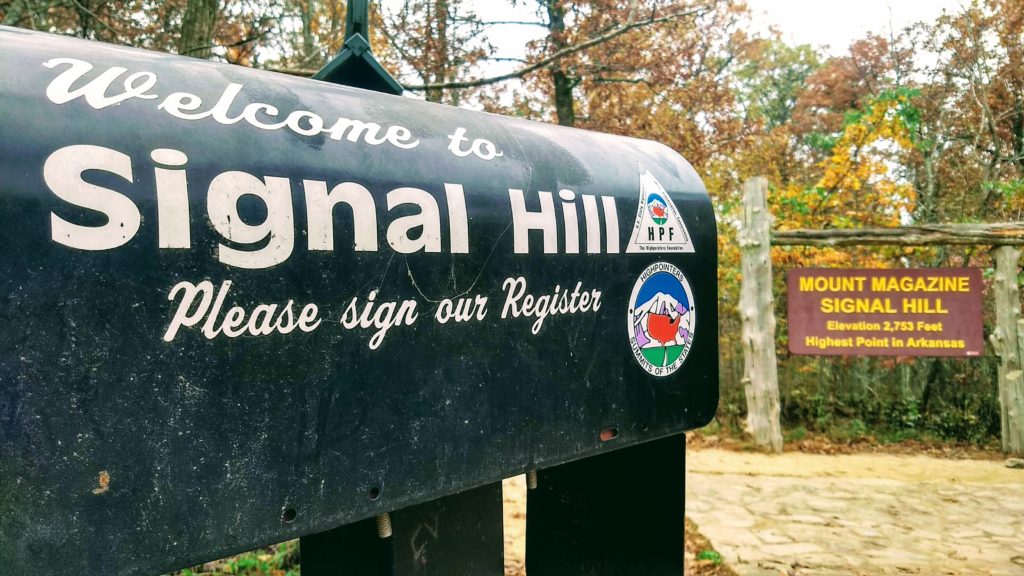
The next morning we shared battle wounds, tears and laughs before departing for the one of our many home states. But I was still on a high from the weekend. So I decided to drive to Mount Magazine and tackle the state’s highest point. Lucky for my legs, I was able to drive most of the way, and the round trip hike was only 1.5 miles! The area was gorgeous and worth the detour despite it being so foggy but I didn’t get to fully appreciate the stunning views I’d heard you get at the lodge.
During the pandemic, I’ve found myself even more thankful for parks, nature and so much outside space to explore. In that, Arkansas has a lot to offer. Driving home, I passed many signs for state parks and couldn’t resist also stopping at Devil’s Den. Also, a wonderful pit stop, if you are in the area. Trails vary in length and that take you to caves and waterfalls. All in all, Arkansas has some superb parks. I know I’ll be back to explore more on foot and bike.
Tips:
- Hiking poles are highly recommended for this trail.
- Check out one of the Ultimate Hike info sessions at REI or calls to learn about to join a hike.
- The more you hike, the more snacks you get to eat. It’s just a fact.
The Land of the Rising Sun from Mt. Fuji
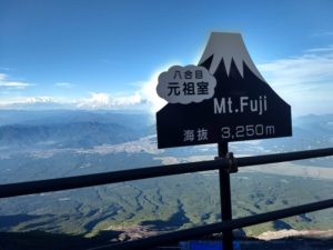
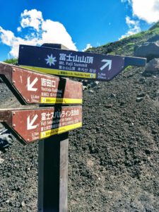
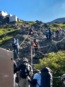 I read everything I could about Fuji but the weather was the determinant. I was staying in Tokyo for almost 3 weeks so I hoped there would be a good weather window. The weather was actually quite nice, so I planned to go on a Sunday to Monday, in hopes that there would be slightly less pilgrims than a Saturday. There were still thousands of people, but I was able to have a few moments to myself when traffic started to thin around the 7th station. Fujisan is broken into 10 stations, and most people start at the last bus stop at the 5th station.
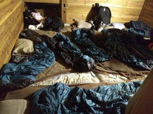
Like giant bunk beds, you had to duck as there was a layer of hikers sleeping above you. Many heads were bumped.
It only took me four hours to get to the hut via the popular Yoshida trail. I thought it would be 5-6 so I was surprised when I came up a switch back and there I was at Tomoekan, my hut at the 8th station. Since it was only 5pm I had some time to relax. I watched an amazing sunset and tried to sleep. At 10pm I still wasn’t asleep so I walked outside and watched a spectacular lightening storm in the clouds straight ahead. When I got back to Tokyo, I heard they had a wild thunderstorm. I think I finally slept a couple hours before my alarm went off at 2am. A lot of people were already geared up, but I lolly gagged because the trail sign said it was only 80 minutes to the top, and sunrise was at 5:15am.
The string of lights are hikers’ headlamps.
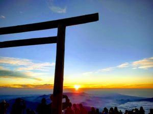
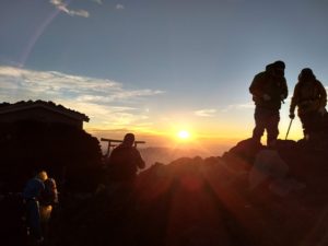
At 4:45am, I finally crossed the last torii gate that signaled the summit. That last 80 minutes actually took over two hours! The sky was just firing up and the excitement was palpable. I found a spot to sit and take pictures, and give thanks.
After a while I walked the trail along the summit which took me to the highest point on Fuji and I saw the full moon setting. It was exactly what I wanted it to be.
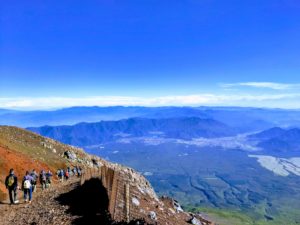
Finally close to the 6th station it started to flatten out a bit. I walked into the helmet rental hut and showed them my arm and said “Band-aid?”. They put some antiseptic on me (which is what I really wanted since I was covered in dust) and bandaged me up. I was happy again.
As I’m getting on the bus, it’s a 2.5hr trip back to Tokyo, a guy walks by wearing a Jack’s Generic shirt, a local Austin triathlon. And of course he’s from Austin but living in Tokyo now! Most of the people I’d seen in Fuji were Asians, but I wasn’t so surprised to see an Austinite, it’s a small world after all.
Tips:
- Take lots of cash for water, food snacks, postcards, and souvenirs.
- The bathrooms costs 200Y each, so bring coins as there’s no change available.
- Buy postcards and international stamps at the 5th station, and mail them at the post office at that station. You can also buy post cards at the mountain huts.
- There’s a website to help English speakers book mountain huts on the 7th station for an extra 1000Y. I missed the three day cutoff for that website, but was able to easily book myself for the 8th station and didn’t have to pay in advance.
- Take Band-Aids, or tape up your feet. They’ll take a pounding on the way down, or you may fall on jagged lava rocks.
Alaska: Land of the midnight sun
My husband’s dream to ride his motorcycle to Alaska was finally realized this month. It would take him about a month to ride from Austin, Texas to Fairbanks, Alaska and back. For me, this was too long to be apart, plus, I also really wanted to go to Alaska! So, we decided I’d meet him there about 13 days into his trip, and we’d spend four days together before he began his return trip home. With only four days in Alaska, visiting Denali National Park was at the top of my list. So, I flew into Fairbanks, the closest major airport, with a stop in Seattle which is at least a 10 hour trip.
Fairbanks
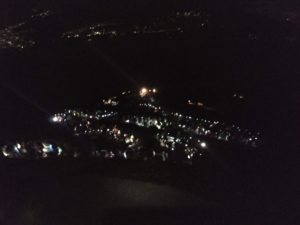
I arrived in Fairbanks at 1am wearing my sunglasses. I couldn’t get over this “midnight sun”. I’d been traveling for 23 hours at that point, and was incredibly disoriented even though it’s only a three-hour time difference. Even with an eye mask, after five nights I never got on a regular sleep pattern.
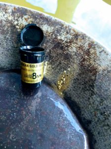 It rained the first day, so we took the very touristy train ride to Gold Dredge 8. It was touristy but still a lot of fun to learn the gold-mining history and pan for gold. Together we found $28 of gold that they’ll conveniently put in a $30 keepsake necklace. For lunch we headed over to The Cookie Jar, which everyone recommended because it was on “Diners, Drive-ins, and Dives”, I loved the name but didn’t find it to be anything special.
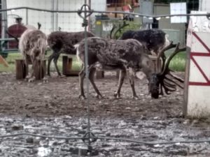
Since it was still raining, our hopes of kayaking were dashed, we headed to North Pole. It’s Christmas year-round in this tiny town. Christmas banners hang from the candy cane light posts in July. We stopped into the Christmas store to take a picture with Santa, and see the reindeer.
We stopped in the sleepy downtown of Fairbanks. There’s a nice paved hike and bike trail along the river, and rentable bikes to check out parked all over. We wandered into the visitor’s center which offers a small museum and lots of local trail maps. I picked a few trail maps, and we ran back to the car in a downpour. What do you do on a rainy Sunday? That’s right – we went to the local Hoodoo brewery. This was a great little spot with a nice outdoor area and a food truck. It’s was a really long day considering we slept so little, so we went to the historic Pump House for an amazing salmon dinner.
 We slept 11 hours that night! This was surprising since our VRBO cabin didn’t have curtains and it was so bright. It was a clear day, so we headed down Chena Springs Road outside of town to hike Angel Rocks. It took about two hours round trip on clearly marked trails. The parking lot was full, but mostly we were by ourselves except for the mosquitoes that just wouldn’t quit. Even with the bug spray and pants I still had lots of bites. We headed a few miles up the road to Chena Hot Springs. As soon as we got in the springs, it started raining again but it was quite nice. I wasn’t too impressed with the Springs themselves, it was just one big pool with moss covered rocks and no where to sit, so we didn’t stay long. There’s also an ice museum that looked interesting, but we wanted to start the 1.5 hour ride back to Fairbanks. We stopped into the Banks Alehouse for dinner, and I got some sad halibut tacos with one piece of fish that was half the diameter of the tortilla. It was good, but I needed a second dinner. I did try this weird gummy bear beer that smelled just like gummy bears and had them soaked in the bottom, but it wasn’t that great either. But I was super excited to head out to Denali the next day.
Denali National Park
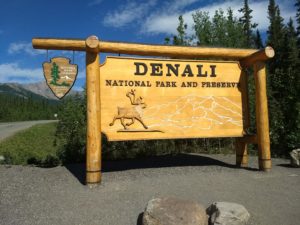
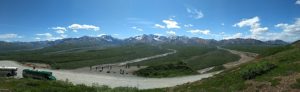
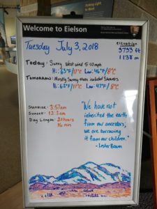
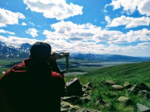
We were on the road by 6am the next morning so we could make the most of our two days in Denali National Park. It’s about a two hour drive from Fairbanks. I wanted to get to the visitor’s center when it opened so we could sign up for the following day’s discovery hike, an off trail hike with a ranger, but it was booked up. You can only sign up for them two days in advance but with the fourth of July holiday I knew it would be a slim chance. Denali is over six million acres, but only has 35 miles of trail, so off trail hiking is promoted. I don’t have any experience with that so I wanted to go with a guide. You can only drive the first 15 miles of the only park road, so buses run regularly to different spots in the park. We got tickets that would take us to the Eielson visitor center at mile 66. This would normally be an eight hour trip but we had an extra hour waiting for a rescue bus when our’s broke down. It was a warm 78 degree day and the the mountain was out so it wasn’t a big inconvenience. 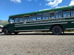
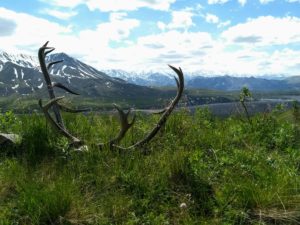
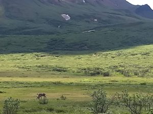
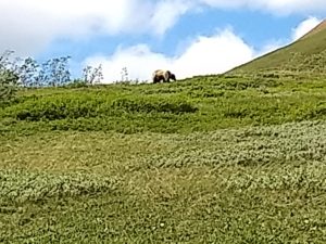
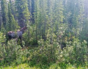
For our patience, we were rewarded with lots of wildlife sightings! We saw at least eight grizzlies, including two cubs, countless caribou, and a moose with two babies right on the side of the road. We were also able to see the Denali mountain, the highest in the U.S. Only 30% of people actually get to see it due to the storms and cloud cover.
I didn’t understand the bus thing as first, but after a long day it was nice to sleep on the way back and wake up when someone yelled at the driver to stop for a bear! The buses cut down on traffic and wasted resources, and it was helpful to have 30 pairs of eyes looking for wildlife. If you’ve ever been stuck in traffic in Yellowstone because a buffalo was crossing the street, you’d appreciate it! And although it wasn’t a narrated tour, the driver answered all our questions and offered some info on the park. Once on a bus you can get off anywhere and pick up a bus going in your direction anywhere as long as there’s room, but after seeing all those grizzlies I wanted to stick to the trails.
The following day we hiked the Horseshoe Lake Trail near the visitor’s center before grabbing a bus to the kennels for the dog sled demo. This is definitely a highlight for animal lovers. You can pet and hug the dogs, and learn about how they are bred and see them screaming around a short track pulling a ranger. It was a warm day for the dogs but they were very exiting to see in action.
We only had a few more hours, so we decided to take a bus to hike the Savage River area. Although this is the farthest spot you can drive your own vehicle, we took a bus because we had such a good experience the day before. This was a mistake. We picked up the bus at the visitor’s center and it made about four stops including returning to where we were picked up before heading out. The 15ish miles took us over an hour and one bus driver’s life story. So word to the wise – check the bus schedule. The Savage River area was beautiful and worth the effort to check out those trails. And we were able to quickly catch a bus back that took less than 30 minutes. Before we left the park, I turned in my Junior Ranger activity book and got my Denali park badge. My 10-year-old self was super excited about this!
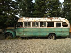
Heading back to Fairbanks for our last night, we stopped at the 49th State Brewery for dinner. The “Magic Bus” from the “Into The Wild” movie sits here with an Enter At Your Own Risk sign. The real bus still sits deep in the back country as a refuge for hikers, just as it was for Chris McCandless until his death. Entering that bus was heavy, and reminded me how wild the wilderness can be. I headed to the airport at 4am the next morning with my sunglasses on.
Tips:
- Take bug spray. Yes, the mosquitoes are as bad as they say.
- Take an eye mask for sleeping, our VRBO didn’t have curtains.
- Don’t forget your towel for the hot springs, or pay a $5 rental fee.
- Even adults can be Junior Rangers! Ask for an activity book at any state or national park, and once completed you’ll receive a badge.
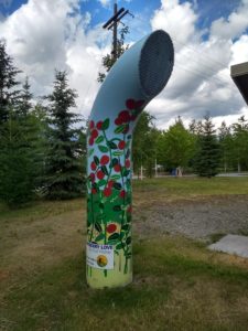
What is this? These exhaust vents are beautifully painted all over downtown Fairbanks.
No this isn’t an electric car. Some cars have plugs so they can be plugged in during the winter to keep the engines from freezing.
Hiking in Argentinian Patagonia
Sometimes I worry that I’ve dreamed of a place so long, it won’t live up to my expectations. This was not the case with Patagonia. I’d wanted to go for years, and luckily this time my husband was able to travel with me. We’d spend three weeks starting in Buenos Aires, Argentina and ending in Santiago, Chile. I knew when we started this wouldn’t be nearly enough time, but nine days would at least give us a taste for all Argentina had to offer. And by taste, I mean, bring the wine and keep it coming!
We touched down in Buenos Aires, for a short overnight before hopping another flight to El Calafate and then a bus to El Chaltén. Our trip would follow a ‘V’ pattern due to the limited flight locations in the Patagonia region. Also because I wanted to spend less time on buses and we didn’t rent a car. After nine hours flying to Buenos Aires, we dropped our bags at the hotel, got a map and went to exchange money. This was our only goal while in BA, because I’d read that changing cash in El Chaltén was hit or miss.
We spent a beautifully warm day walking around eating empanadas, but we were eager to get south. We caught our flight early the next morning out of the domestic airport. It only took 15 minutes to get from our hotel to the gate – the small airport was easy 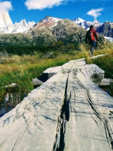
to check into, and has a cafe. Our three hour flight put us outside the town of El Calafate. We had pre-booked a shuttle to the quiet hiker’s paradise in El Chaltén. Once there, we finally checked into our hosteria where we’d stay for the next five days.
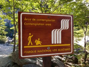
El Chaltén, Argentina’s trekking capital, can be walked end to end in 15 minutes. We heard many accents and languages, even a hiker couple fighting in English which was neither of their first language. There are restaurants, bars, a couple grocery stores, laundry facilities, a bus stop and not much else. The ranger station provides free trail maps of Los Glacieres National Park, which makes up a portion of Patagonia, and we planned to do day hikes each day. The routes lasted anywhere from one hour to five days and all the trails can be accessed directly from town.
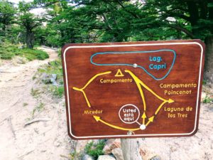
The trails are easily marked and well established, we never worried about getting lost. There are also large maps at the main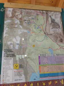
trailheads, and even rangers there answering questions and reminding hikers of trail etiquette and keeping the park clean. A few primitive bathrooms were also available. I was very impressed with not only the trails but the views – WOW! The views of the Fitz Roy mountain and surrounding peaks and green lagunas were worth the hikes. The week offered mostly clear, sunny skies but a lot of wind, for that area mother nature was at her tip top best. Although we went in high season, we never felt like the trails were crowded. We’d see lots of people at the major viewpoints, but often we’d be walking alone, which was perfect. A few days in we decided to go for a sunrise hike near town. I heard you could see the sun hit the mountains spectacularly, and it was just that. It was a short, very quiet 45 minute hike to Los Condores, and we weren’t even the first ones. A handful of other tourists had arrived before us.
Hiking in the Patagonia region reminded me of what I enjoy about hiking – the scenery, the challenge, but mostly the peacefulness. Each evening after hiking, we’d have a big dinner and a bottle of wine, and it was very rejuvenating. It was also really hard to leave. I’d felt like I spent so much time researching this trip, but being there it was really quite easy. Even if I was a solo female hiker, I would have felt very safe. But we were really excited to get back to El Calafate.
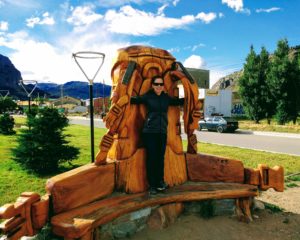
You know you are in a backpacker’s paradise when the city park bench looks like a giant pack.
We took a bus back to El Calafate and we had the afternoon to explore, and while it was defiantly livelier than El Chaltén, we were still able to walk almost everywhere. Almost everywhere – we heard about a Glacier Museum with an ice bar that sounded fun. So, we found their free shuttle bus that took us the three miles to the museum. I can’t say how the museum is, but the Glacio Bar was a blast! The museum itself is in a beautiful building, and the bar is in the basement. We paid the $10USD per person, and got a 25 minute all you can drink, “this is what it must feel like inside a freezer” experience. After donning the provided capes and kitchen mittens, our group entered the tiny room. The few tables, chairs, bar and glasses were all made of ice, and the club lights and Justin Bieber music had me drinking and dancing just to stay warm! It took about five minutes before I was cold (I’m from Texas after all), but my husband said that’s what the straight vodka was for! It was hilarious, and absolutely worth it to take the unexpected detour – as it usually is.
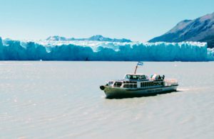
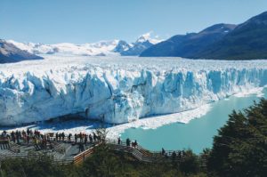
The next day we visited the Perito Moreno Glacier to do ice trekking with Heilo y Aventura. They are the only company that offer glacier trekking, and it was definitely a highlight. It’s much cheaper to take the local bus, but we really wanted to wear crampons and hike on a glacier. If you can spend the money, I’d highly recommend this excursion. The tour includes a boat ride across the lake, where you get your first glimpse of the glacier’s magnitude. The most interesting thing about it is that it’s advancing and not receding like most glaciers. We got a trekking tour on the glacier, had lunch and took the boat back across the lake. Once across that lake, we took the bus to the main park where the viewing boardwalks are packed with spectators waiting for the ice to calve. And when it did, it was an amazing site! But after trying to get a good view around so many people, we were even happier we took the tour because it felt more private.
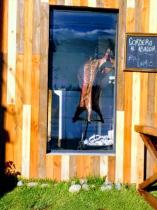
We were headed to Chile early the next day, so we had one last dinner of lamb and wine. It wasn’t hard to travel around by buses and that’s how most people got around. But we were limited to the days the buses crossed the border. I had only really planned one thing for this trip and that was a day in Antarctica, so no matter what else we did I had to be in Chile on a specific day. Unfortunately, that was a day there was not a bus from Argentina to Chile.
After some searching, I emailed a couple different companies to see if they had private shuttles that would leave early enough to get us across the border to Puerto Natales. Once there we’d catch another bus to Punta Arenas, Chile. Emails were sent, and payments were made via PayPal, so I wasn’t super confident this was legit. But after the whole trip, all the pre-booked transportation I made was on time and exactly as described. So, a large charter bus showed up at our hotel bright and early with many other travelers in the same situation. The border crossing was quick and easy to get our passports stamped leaving Argentina. We stopped again five minutes later at the Chile border. It was also easy but remember to not take any fruit or nuts with you! They made me throw away a banana and an apple, even after I asked if I could just eat it right then – that was my breakfast after all.
There are many parks that make up Patagonia, and after being there I’m eager to explore more of them. All in all Argentina had been everything I hoped, but now on to Chile!
Tips:
- Change dollars to Argentinian Pesos in a big city before traveling south to Patagonia. There’s only one ATM in El Chalten,
 which apparently runs out of cash, plus many places don’t take credit cards.
 - The WIFI is slow, and I didn’t see one TV in town, including in our hotel (just in case you were hoping to watch the Olympics).
- The daylight hours are long in summer.
- Many hotels have lunchbox (“viandas”) options, that are prepared and ready for you the morning of your hike, costing about $10-15USD.
- If you cross the border, check for items not allowed to avoid throwing away food. Food is not cheap there.
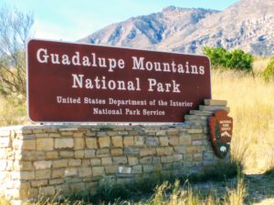
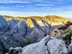
Hike to the Top of Texas: Guadalupe Peak
You’d have thought we were just another Thelma and Louise, without the Brad Pitt part. I woke at five a.m., eager to start our eight hour road trip to West Texas. You’ll understand if you’ve ever driven through West Texas, it’s a flat, high-speed expanse of big sky ruralness. But a perfect place to escape it all, a place to soothe your soul and an inopportune place to run out of gas. My husband might describe it differently, using more romantic and dramatic words, and perhaps that’s the point. It’s a place that will fill you up with whatever you need, that is except gasoline.
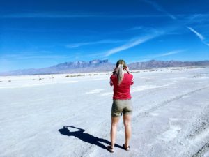
My friend, Kimberlee, and I set out to bag the summit of Guadalupe Peak, the highest natural point in Texas in the Guadalupe Mountains National Park. At an honorable 8,715 feet, it ranks 14th out of highest state points. We took Friday off of work, arriving around noon, hoping to get one of the peak’s five backpacking permits. Even though we got pulled over just outside Fort Stockton by a very kind highway patrolman, we still made great time. He reminded us to slow it down a bit and then sent us on our way. We were able to snag one of the last backpacking permits, which are free, knowing it would be a busy weekend for the Veteran’s holiday. We wanted at least four hours of daylight so we wouldn’t have to set up camp in the dark. The backpacking campground sits about a mile from the summit. We planned to be at the summit the following day in time to catch the sunrise.
We rolled into camp in just under three hours after many stops. The weather couldn’t have been better, it was hot when we started but after rounding the bend, the trail becomes shaded and windy and a comfortable temperature. Although it was barely five p.m., Kimberlee cooked up a very tasty chicken and dumplings Mountain House dinner. By 6:30 we were snug in our Big Agnes Fly Creek tent (on clearance now at REI, plus footprint). Exhausted from the drive and hike, we fell asleep immediately but woke up often to the howling winds. My friend had recently summited, so I was well-versed in the high winds and took extra heavy duty tent stakes. But I was still nervous each time the side of the tent was mashed against my face. You could hear the wind gathering force like a giant wave, roaring up from the valley and threatening to rip the rain fly right out of the ground.
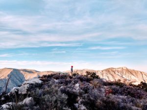
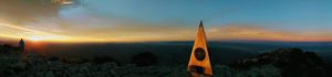
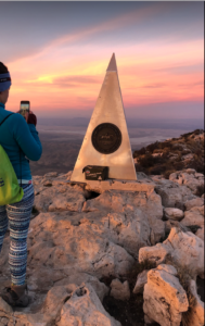
Eleven hours later, I unzipped the tent to a stunning fire banded sky – one dazzling red strip between the black. I was gobsmacked. As we headed up the summit, I kept stopping to watch the sky but had to wake myself back up and keep going. It took less than an hour, and we had enough light about halfway to turn off our headlamps. As I rounded the last corner, I saw the summit marker just above me. Victory! The wind was ruthless, but I found a small spot behind some rocks that allowed me to sit and watch the sunrise in peace. It’s a very humbling and spiritual thing to reach a summit, to see the Earth as the big beautiful thing it was intended to be, to shut out the noise and just be present.
After a short time of book signing and selfie taking, we headed back down to camp. We left our packs inside the tent to hold it down while we were gone and luckily our tent was still attached to the earth. Another backpacker said his tent had flown halfway down the hill. Our Mountain House Mac and Cheese breakfast was a fail, but nothing could break out spirits after that sunrise. We passed a lot of people on the way down hiking the peak as a day hike, but I’d highly recommend catching the sunrise or sunset at the top. It really is the best view, and you won’t have to share the moment with many others. There was only one other person for part of the time at the top with us. All in all, it took us about six and a half hours with packs.
Guadalupe Mountains National Park is one of the least visited national parks, probably because of the remote location near the Texas/New Mexico border, and also because it doesn’t have many camping spots. All 20 tent spots are first-come-first-served with no reservations. When we got to the trailhead in the campgrounds about 10:30am, we were lucky to snag a campsite from someone that was just leaving. We ditched the backpacking tent, and set up a more spacious home, complete with a spot to hang my Madera Hammock.
After resting a bit, we headed over to the visitor center to check out the exhibit. It had lots of really good info on the park, and animal replicas. We also discovered that you do NOT have to be a child to become a Junior Ranger. We diligently worked on the provided workbook, and earned our first Junior Ranger badge!
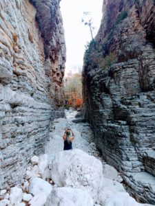
We were so excited about our new badges, we set off to hike Devil’s Hall Trail. Although, it took us less than two and a half hours, this trail did required some scrambling. It’s an easy first mile to the wash, then it’s mostly unmarked, but just keep going. If you follow the wash, you’ll eventually end up at a pretty cool site. But make sure you take a torch or keep an eye on the daylight because you are in the shaded creek bed.
Then lucky for us, there was a star viewing party that night. Two astronomers had set up their telescopes, as if the stars in that dark sky weren’t amazing enough. They pointed out some amazing sights, and we took turns on the telescopes. It was an excellent cap to the day. Some deer joined us for our Sunday morning breakfast before we packed up. Besides one roadrunner, we didn’t see much wildlife. We headed a mile up the road to the Frijole Ranch. From there, Smith Springs is about an hour easy hike that offered us some beautiful fall foliage. Not something we get a lot of in Central Texas.
We wanted to hike the McKittrick trail, which may have the best viewing for fall colors, but we were having a minor gas crisis. No matter what direction you come from, the nearest gas station may be 30 miles or more from the park. Even knowing this we failed to fill up and found ourselves driving 40 miles out of the way to Dell City. It’s a small town with two gas stations, both of which are closed on Sundays, but we asked someone on the street and they directed us to a small credit card station, so we were able to get gas before we were on fumes. It was a wonderful weekend being in nature, but I was ready for a shower. And it’d be eight short hours before I’d finally get one.
Tips:
- The Guadalupe Mountains National Park is in the Mountain Time Zone (MST), right on the border.
- Expect high winds at the top and prepare accordingly. Take extra tent stakes if you are camping, and a headband to keep your hair from whipping you in the face.
- Plan to take at least a gallon of water for Guad Peak. There is potable water near the trailheads, but not on any trails.
- The nearest gas station is at least 30 miles away from the park, plan accordingly.
- Fires are prohibited in the park, take a camp stove.
- Take trekking poles, the made a huge difference to me and I don’t usually use them.
New Zealand is for the birds
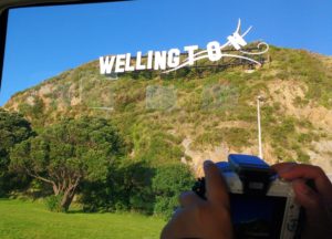
Despite the long flight, on which I finally watched Lord of the Rings, New Zealand was everything I hoped. I landed in the capital city of Wellington jazzed to spend the week. I resisted the urge to nap (17 hour time difference) and immediately went for a walk to shake out the cabin fever (17 hours in the air). A bus took me up to the Mount Victoria lookout, or more commonly called Mt. Vic, to catch the sunset, and I got an amazing panorama view of the city. Because of all the hills, I soon found out there’s a lot of amazing viewpoints in the city.
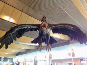
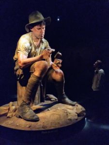
Gandalf in the Wellington airport.
The first night I walked over to the Lux Light Festival on the waterfront. It was a really cool and somewhat interactive display of lights, video, technology and water spread across a few neighborhoods. And there was a taco food truck, so it was pretty much perfect. I was surprised that even though it was a festival and there were lots of people, I never felt crowded – a stark contrast to festivals in Austin.
I heard about these glow worms in the Wellington Botanical Gardens, and it was definitely a highlight. It wasn’t a far walk to the Gardens from the CBD, or Central Business District, but I quickly learned most things are uphill. It’s early winter in New Zealand and the temperatures were pleasantly in the 50’s, with little wind. “Little wind” is not really a thing in a city nicknamed “Windy Wellington”, but it was a nice week and it stayed under 25 mph. The Gardens are free and have many beautiful trails, but you have to go at night for the glow worms. I followed the paths to a creek and turned off my flashlight. After my eyes adjusted, tons of tiny glow-in-the-darks spots were all around me. It was an incredible sight.
This might sound scary – alone in the woods at night. I was definitely thinking, “This is how every horror movie starts.” But Wellington, with it’s high education level and low unemployment, has relatively low crime and fun fact: it’s the number one least corrupt country. I read that on wikipedia, so you know it’s true. In case you are wondering, the US is 18th. So, if you are a female solo traveler, I’d highly recommend New Zealand.
I never felt concerned for my safety, people were quite friendly and I even met a handful of Americans living there.
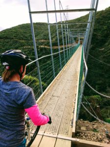
Wellington is known for its numerous mountain biking trails and they did not disappoint. Makara Peak offered a swinging bridge and some nice smooth trails with lots of switchbacks, which were great after going straight uphill which seemed like forever. I rented a bike from the awesome folks at Mud Cycles, and even had a female American tour guide.
Another notable thing about Wellington is their large number of craft breweries. You can even pick up a map for the self-guided craft beer trail. I stopped into Fork and Brewer for a drink, and was surprised at the number of their brews. They offer flights or half pints if the selection is too overwhelming.
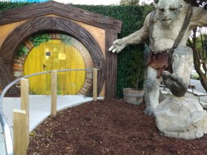
You can easily find the Weta Cave by the trolls outside.
And of course I couldn’t go to New Zealand without checking out Peter Jackson‘s Weta Cave. You don’t have to be a LOTR’s fan to appreciate the costumes, props and digital mastery that is created there. The tour itself was just ok, but you can always check out the Weta Cave’s gift shop to see some props, or even purchase a LOTR replica sword or the Sword of Boromir movie replica for only $9999.
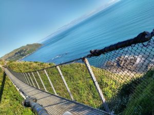
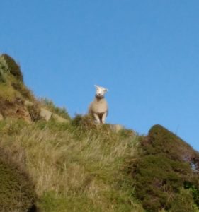
My favorite day was hiking 10k of the Te Araroa trail. I took a train about 40 minutes out of the city to Paekakariki, the trail follows the railway, and spent the next three hours marveling at the amazing view of the Kapiti Coast. The trail is well marked, with steps that go up and up and up, and a couple swinging bridges. Not to mention all the sheep friends I made.
What about those birds, you ask? While New Zealand is known for the kiwi birds, them and many other species are on the brink of extinction. The country has many ongoing efforts to preserve the natural habitats for all the amazing wildlife, and you can’t help but hear the birds’ songs in all the parks. The city of Wellington has many beautiful earthquake-proof buildings, one thing I luckily didn’t experience while I was there.
I read an article by Alton Brown on his food journey in New Zealand, he said “On my way to the register, I make accidental eye contact with three total strangers, and every one of them smiles back.” That really summed up my experience also.
Flying from Auckland to Wellington, get a window seat so you don’t miss the volcanoes.
Tips:
- You don’t really need to change money. I used my credit card (one that doesn’t charge exchange fees) the whole time. There were a couple places that changed me a minimal transaction fee. Also, I hopped on a train without a ticket and they only take cash onboard, so buy tickets ahead of time if you want to use credit cards.
- You don’t need a car if you are staying in the city. You can walk, bus, Uber, or train almost everywhere.
- Explore the many trails by bike or foot, and you’ll be rewarded with excellent views.
- Check out the National Te Papa Museum, it’s worth every penny. Also, it’s free.
- Make time to hike the Te Araroa trail from Paekakariki to Pukerua Bay, this was hands down my favorite activity.
The larger than life display at the Te Papa Museum create by Weta for the WWI exhibit.
The Old and New Capitals of Japan
The force was with me.
Tokyo
It wasn’t until I stepped off the train and couldn’t read anything, that I thought, “How did I get here?”. But that’s what happens when you tell me you are going somewhere interesting. So be warned – I invite myself along. To be fair, I did give my sweet co-worker, Lynda, a chance to say no, and made her ask her sister, who was traveling with her, if it was okay. But I jumped at the chance to burn my last two weeks of PTO visiting Asia.
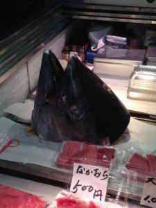
Tuna head in the fish market.
So, there I was – wishing I’d at least attempted to learn a few helpful phrases, but it was too late now. Fortunately, I had the address to my AirBnB written in English and Japanese, because I definitely got lost my first ten minutes of getting off the train. Turns out, this would happen many more times in the next five days.
For my first day in Tokyo, I booked a bike tour around the bay. I love being on bikes, but it’s also a good way to see a lot when you have limited time. It’s also nice to have a tour guide answer all my cultural questions, like where can I dress up like Mario and drive a go-kart around Tokyo? (It’s a real thing.) We visited some shrines, temples and the fish market, which is everything you’d image including tuna heads that weigh more than I do!
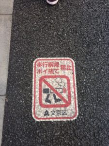
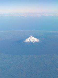
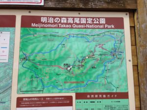
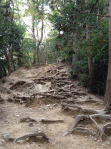
The following day, I decided to get out of the city. I took a train about an hour outside of Tokyo to Mount Takao. I wanted to go where the Japanese go to get away from it all, and I knew I was on to something when I was the only foreigner on that train. There was a helpful English pocket guide and info desk that explained the six different trails and other things I could find at the top, like a temple and some food. The most popular trail is a paved walkway suitable for anyone, but I chose a more remote trail. Each path has an estimated time from 30-110 minutes, and there’s even a chair lift to make it more accessible. It was a steep, beautiful autumn climb, and I was lucky to be able to see Mt. Fuji from the top despite the clouds. After a few hours hiking, I walked over to the Trick Art Museum across from the train station. I’d highly recommended going with one or two friends to take fun photos, but I still had fun by myself.
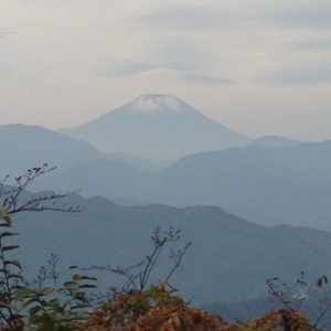
View of Mt. Fuji from Mt. Takao on a partly cloudy day.
We spent our last night in Tokyo at a capsule hotel, which is a unique experience. I didn’t feel claustrophobic because the capsule was much taller than I expected, but even t
hough you have a locker, there isn’t much space. It did have a double locked women’s only floor with free amenities, a robe, slippers and blowdryers. It was good for one night, but I was happy to move on the next day. We went to the nearby Anthony Bourdain visited Robot Restaurant, which is like a dinner show without the dinner and if you’d walked into the worst hotel in Las Vegas, and were on drugs. Some might disagree, but for me it was a total waste of $66 to watch pandas, samurais, maybe a dinosaur dance around the stage to a loosely based story about trying to stop robots from taking over the Earth. I didn’t get it.
Kyoto
The next day we took the shinkansen bullet train to Kyoto, and stayed at another AirBnB. The house was over 60 years with low doorways, lots of windows, and tatami mats (which are suprisingly comfortable). We wanted the traditional Japanese living experience, but we had to keep reminding each other to take off our shoes in the house. Wooden blocky sandals were provided, but for me they were too big and difficult to walk around in.
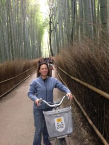
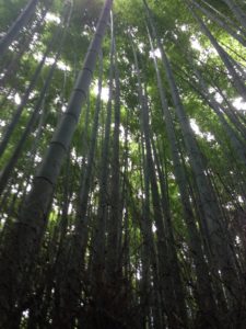
In Kyoto, I most wanted to visit the bamboo grove in Arashiyama. There was a lot we wanted to see, so after getting off the train, we rented bikes for the day (~$10). Did I mention I love riding bikes? I didn’t realize how touristy this area would be, but the exploding fall colors demanded an audience. There are a number of temples, but many cost a few dollars, and since we’d already been to a few for free we opted out. You could spend days just in this district. There’s a monkey park, a lake for boating and fishing, large temples, restaurants, and of course the grove path. We were told we couldn’t bike through a section of the grove, and we couldn’t even if we wanted to because there was so many people, and a number of rickshaws pulling visitors – it was like a strong man competition! After we got through the crowded part, we were able to bike again and it was perfect. I’d guess the path is a mile or two, so the bikes were a good idea.
I also wanted to visit the Fushimi-Inari-Taisha Shrine after seeing beautiful pictures of the torii gates, so we left Arashiyama although we could have stayed the whole day. There are large signs announcing the shrine’s #1 Trip Advisor status for foreign visitors or something similar to greet you, and once we entered I understood why. All of the information at most of the shrines we visited are in Japanese, so while we could appreciate the beauty, we largely didn’t know the details. The Fushimi-Inari had handy QR codes in multiple languages with lots of info. This makes a world of difference if you are interested in knowing the history and significance of everything. We followed the never-ending path beneath to orange torii gates, which get replaced with bigger and bigger gates as one’s prayers are answered. I say never-ending because we walked up and up for maybe two hours, and still not even close to the top, and since it was already dark we turned around.
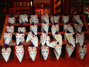
Prayer placards at Fushimi-Inari.
Our last day in Kyoto was basically spent getting back to the Tokyo airport. I took the metro to the shinkansen to Tokyo, and then to the Narita Express to the airport. The 50 minute Narita express is a great way to get to the airport from the city, but it only runs every 30 minutes, and while the trains run regularly we still barely made our flight. I got sidetracked looking for souvenirs in the Pokemon shop.

Eight kittens in a stroller. Just a regular day on Takeshita Street.
Japan, in general
Ooooh, the FOOD. While my knowledge of Japanese cuisine is limited, I was most looking forward to the food. And I wasn’t disappointed, except that when I left I realized I never even ate sushi! My favorite meals were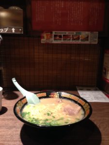
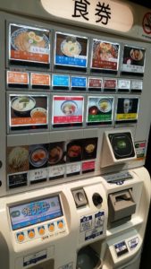
the shabu-shabu, and the ramen. The meals were all a lot of fun because they were more communal, except for the ramen. We decided to find a 24-hour ramen place for breakfast one day. After walking around lost for 30 minutes and asking many people, we finally found the tiny door that took us down some stairs. There we found a small vending machine with pictures of bowls of ramen. We selected the bowl we wanted and the machine spit out a ticket. We sat at a bar with little walls that separated you from the person sitting next to you. You can take these down, but we didn’t figure that out until we were leaving. The screen in front of me lifted up and all I saw were a pair of hands take my ticket. I filled out a form to select how much spice, fat (oil, I think it meant), flavor etc. and handed that to the hands, and then the screen dropped. It only opened again to deliver our bowls. We also ate yakatori, Japanese BBQ, curry, soba noodles, and many things I don’t know what they were. There just weren’t enough meals for all the things I wanted to eat.
Ramen vending machine. Photo credit – Kathy Tran
I can’t tell what these dishes are or what the difference is between them.
But it was the culture and people I found most interesting. The people are orderly, rule-followers, and concerned with not offending others. They don’t talk on their cell phones on the trains, and they don’t jay walk. They let you browse their shops without question and they are kind and helpful when asked. A stark contrast to what I’d left in the US in the wake of the election. Even during rush hour on the train, or on a busy shopping street, there was a calmness – it was safe. I never felt threatened, even when obviously looking like a lost female tourist – no one ever approached me – I had to seek out the help I wanted. And the country itself is extremely clean. But the most interesting thing is they don’t like dragon back tattoos (possibly this sign means any tattoo, but specifically dragons). 
To be continued in Singapore…
Tips:
- Get a pocket wifi. But know that even if you do and use Google maps – you may still get lost (or maybe that’s just me). But that’s ok, it’s part of the fun.
- Buy a JR pass before you go. It was well worth it if you plan to travel to other cities.
- Stay near the sights you want to see, so you don’t spend all your time on the metro.
- Yes, the flight is long (about 14 hours from Houston to Tokyo). Go anyway.
This is me lost. Also, there’s lots of 7-11s.
Ultimate Hiking on the Lone Star Trail
Many years ago I hiked Mt. Kilimanjaro. The company I worked for sent out an email, which most people promptly deleted, to get a group of people to each raise $5000 and hike Kili. The donations we raised would benefit a community outreach organization that provided home care to those infected with HIV/AIDS. This had my name written all over it. The only downside for trips like this is that you are on the hook for any funds you don’t raise, and that probably scares some people. Well, I didn’t raise all the money, but I can say I summited the highest mountain in Africa.
So, when I read a tiny blurb imbedded in a work email about a hiking coach needed for 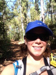
Cure Search I was intrigued. Next thing I know I’m on the phone with the organizer offering my services. While I’m describing my qualifications to Michelle, the organizer, about the hikes I’m completed, the run club I coach and my love of endurance events (that may have been a slight fudge of the truth), I realized how thankful I was that I saw the opportunity and just said yes before I had time to doubt myself.
In that moment, I was the person I wanted to be. But could I coach the hikers to success? Would I be able to encourage them, and would I even be able to hike 25 miles in one day? I was unsure.
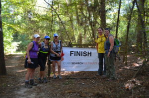
The Ultimate Hike for Cure Search in Texas goes like this: a one day hike of 22.7 miles on the Lone Star trail in the Sam Houston National Forest while participants raise $2500 for pediatric cancer research. The Austin area group consisted of seven hikers and their coach – me. We would meet other hikers from around Texas at the actual event.
Every couple of weeks we’d meet at a central Texas trail to hike for 3-6 hours. We had about ten weeks to train, starting in August – the hottest time to be outdoors. But we did it anyway, which is the best part of having a team. We explored Austin’s River Place Nature Trail, Lake Georgetown’s Goodwater Trail, Dripping Spring’s Reimer’s Ranch Park, and Pedernales Falls State Park.
Pedernales Falls training hike.
During training we encountered high humidity, never-ending heat, no shade, cactus, spider webs (let the tallest person go first), snakes – including a coral snake, tree branches that jump out of nowhere and smack you in the head, and all the beauty the hill country could offer. I just needed a reason to finally explore the local trails with new friends.
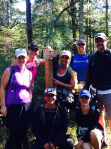
My new friends!
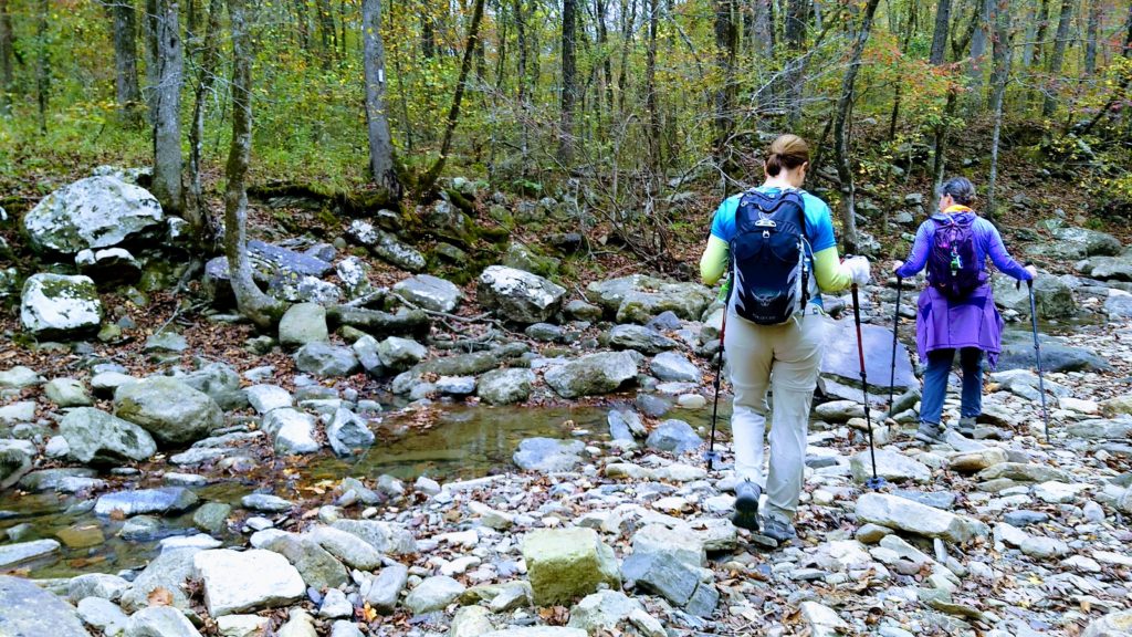
I was confident we’d all survive the Ultimate Hike, even though the most we hiked as a team was 14 miles. Our Austin hikes were hilly, rocky and un-shaded, but the shady Lone Star Trail had small undulations and soft piney needle terrain. It was a moderate October day that started out chilly, ideal conditions for our 11 hour hike.
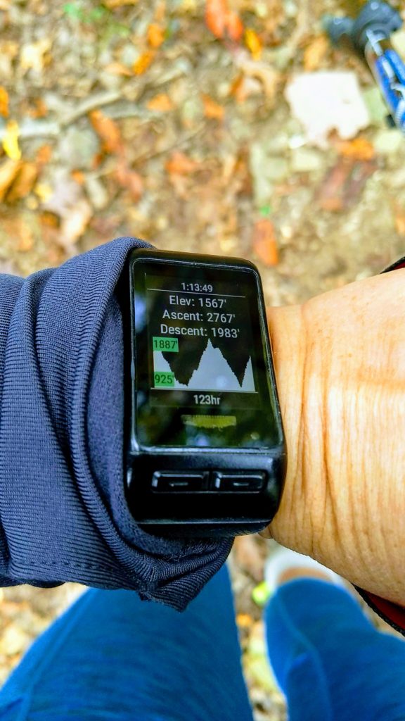
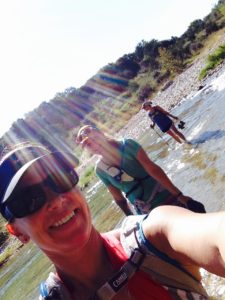
We arrived at the trailhead at a very dark, cold and early 4:30am. While I have hiked in the early morning hours before, we started summiting Kili about midnight, it is wearing on the soul. You have to be extra aware of tree roots in those dark hours and a few people fell. You have to be extra aware of your map directions, as the signage is easy to miss. And miss it we did. After only a mile, we found ourselves unclear of which direction to go. We stumbled around a campsite for about 30 minutes until someone realized we missed our turn. After we were back on track, and especially after sunrise when it started to warm up a bit, we were able to appreciate the journey. We had two aid stations about eight miles apart where we re-fueled and rested our feet. By 3:30pm, all of the hikers had completed the trek. My GPS watched died somewhere after 20 miles. I guess after I logged 50,000 steps it was too tired to go on, but not us!
We showed up in Cleveland, TX on a Friday night, and shared our stories for why we were here. Some hikers had kids that survived cancer, and many had friends, nieces or brothers that had been affected. Others, just understood the importance of the mission and wanted to help prevent more families going through that hell. For me – my dear friend Erin (see New York) survived leukemia as a child, not only is she a doctor today, she is my hero. These amazing hikers raised about $35,000. Something amazing happened that day. The hikers experienced a physical success, but the lasting impact of their donations will be felt by families they may never know.
Why we do this.
Tips:
- Just say yes. Get involved, volunteer or donate to any cause that moves you.
- Cycling jerseys are great for hiking and those extra pockets are perfect for snacks!
- Training is the time to test out your equipment and clothing. Buy the fancy socks and boots – your feet with thank you or at least not hate you.
- Explore! Enjoy the beauty and quiet of the outdoors as often as you can.
Sea turtles, stingrays, and painkillers in the Virgin Islands
I was a tad concerned about traveling to St. John. The logisics of renting two cars, taking ferries and getting my family from one island to another could have been painful. But it was surprisingly easy, and I think the Cruzan rum samples at the St. Thomas airport helped. Driving on the left-hand side in American-style car is always a little tricky, so it took a day before we were consistently driving on the correct side of the road.
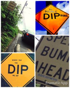
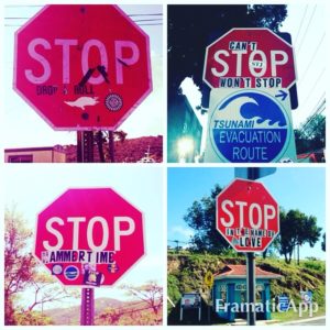
Due to the car ferry schedule, we headed straight to St. John, and didn’t spend any time on the larger island of St. Thomas. Although St. John is only seven miles long with no stoplights, there was plenty to keep us busy for a week. The few roads are steep and windy, but the speed limit is only about 35mph on most of the island. The rental car companies really like to stress renting a Jeep, we did just fine with a standard car at half the price. Someone even has an excellent sense of humor, because we really enjoyed the funny sayings on many of the road signs.
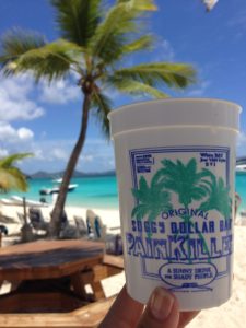
The Cruz Bay town has most of the island’s shops and restaurants. Our first stop on the island was at Joe’s Rum Hut right on the water, which is an excellent bang for your buck. There are many casual restaurants with happy hour specials to check out, but as with most islands most of the food was just okay. Our Westin hotel room had a kitchen and grill, so we ended up buying groceries and cooking our own meals a few nights. But do not miss their popular and delicious island drink: Pain killers.
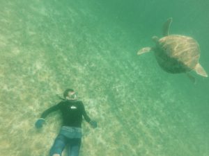
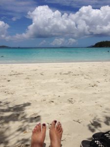
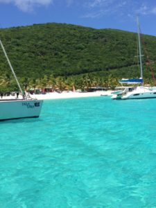
St. John’s numerous beaches all offer excellent snorkeling. I’d be hard pressed to pick a favorite, because we went to five and they were all slightly different, but they all offered the same clear blue water. Maho was shallow and teaming with sea turtles just off the beach. Cinnamon Bay had less snorkeling but a longer beach with facilities, and we easily ducked under some trees during a passing rain cloud. A lot of cruise ship passengers end up at Trunk Bay, which is also the only beach that charges a fee, so it can be a bit crowded.
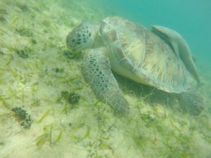
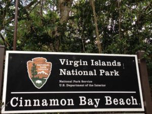
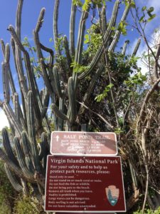
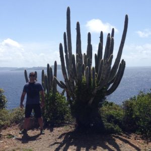
Not only are the beaches a bit of paradise, but 60% of the island makes up the Virgin Islands National Park. We forgot our National Park Pass at home, but all of the trails were free. There are only a couple of roads on the island, so it’s easy to find the well marked trailheads. We ventured to Ram’s head, a 2.5 mile trail located at the southeast tip and lined with giant pipe organ cactus and turk’s head cactus with its hot pink fruit. After a hot hike, we jumped into Salt Pond Bay to check out its turtles and reef fish. On the way back to Cruz Bay, we had lunch at Shipwreck Landing, which had the best grouper sandwich on the island.
Don’t miss the trek to Waterlemon Cay. We took the 30 minute shaded hike to snorkel among stingrays, colorful fish and lots of sea urchins. It definitely had one of the better reef areas for snorkeling, but only offered a tiny rocky beach. Oh, and its WaterLEMON. I mistakenly called it “Watermelon” the whole time we were there.
Ignoring the rain clouds and starting the hike to Waterlemon Cay.
On one of my favorite days, we took a day cruise on the Bad Kitty to check out some of the BVIs. After getting our passports stamped and paying our exit fee, we headed to Virgin Gorda. We were whisked through the batholiths, and didn’t have much time to explore or hang out on the amazing beach. I definitely wished we had more time there, and if I ever make it back I will plan a day trip just to Virgin Gorda. We had an unexciting stop on Cooper Island for lunch before heading to the Indians for snorkeling. You can only get here by boat, and it was easily the best snorkeling we did. And we had already had days of amazing reef exploration. We only had about 30 minutes, but my family was the very last ones back on the boat. We were dragging our fins, if you will! Our last stop, was Jost Van Dyke – an island of 250 residents and 29 bars. I’m almost positive Kenny Chesney has written whole albums while sipping pain killers at their tiny Soggy Dollar Bar.
Jost Van Dyke Island – Home to the famous Soggy Dollar Bar.
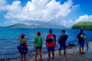
The six of us had an amazing time, venturing off to different beaches and meeting up again for dinner. Usually after a week on a small island I’ve seen enough, but I can see why my friends return year after year. Our week ended way too quickly, and I don’t think I’d ever tire of that water. But we were off to upstate New York for a wedding.
To be continued in New York…
Tips: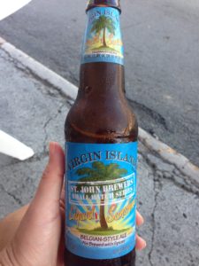
- Someone check out Reef Bay Trail and tell me about it, since we didn’t have time to see the petroglyphs! And if the return hike is too much, schedule a boat with the park service to meet you at the end.
- You can rent stand up paddle boards (SUP) at a few beaches for an above water adventure.
- There are many cays with lobster hunting potential. There is a 2 per day, per person limit.
- Utilize the grocery stores, everyone is super helpful.
- Try to spot a mongoose.
- Did I mention happy hours?
- Check out their local brews, and rum here is cheap (its the mixers that are pricey).
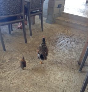
- Why did the chicken cross the road? No, seriously. I stopped to ask one, but she was such a diva. There are chickens all over the island, including these two that wandered around the restaurant we were in.